
Saxony
1,500 known cemeteries in Saxony, Germany.
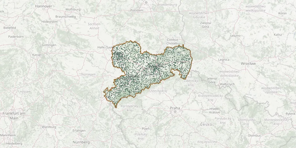 © OpenStreetMap
- Steinbach CemeteryGPS coordinates: 50.55480° N, 13.16008° E
- Steinbach CemeteryGPS coordinates: 51.20746° N, 13.62895° E
- Steinbach CemeteryGPS coordinates: 51.16968° N, 12.59931° E
- Steinberg CemeteryGPS coordinates: 50.54321° N, 12.50471° E
- Steinheidel CemeteryGPS coordinates: 50.48185° N, 12.71718° E
- Steinigtwolmsdorf CemeteryGPS coordinates: 51.06298° N, 14.34497° E
- Steinitz CemeteryGPS coordinates: 51.34142° N, 14.38379° E
- Steinölsa CemeteryGPS coordinates: 51.27954° N, 14.69956° E
- Steinsdorf CemeteryGPS coordinates: 50.56201° N, 12.13427° E
- Stenn Resurrection Church Parish CemeteryGPS coordinates: 50.68146° N, 12.43228° E
- St. George Cemetery, SchwarzenbergGPS coordinates: 50.53619° N, 12.78033° E
- St Georgen KircheGPS coordinates: 51.35392° N, 13.49730° E
- St. Jakobus-KircheGPS coordinates: 51.17738° N, 13.54305° E
- St. John Cemetery, Adorf/VogtlandGPS coordinates: 50.32346° N, 12.25311° E
- St. John Cemetery, NaundorfGPS coordinates: 51.11674° N, 13.61103° E
- St. John New Cemetery, ZaschendorfGPS coordinates: 51.15654° N, 13.50295° E
- St. John Old Cemetery, MeissenGPS coordinates: 51.15913° N, 13.48486° E
- St. John's Churchyard, ZwenkauGPS coordinates: 51.21849° N, 12.32912° E
- St. Just CemeteryGPS coordinates: 51.27165° N, 14.08887° E
- St.-Katharinen CemeteryGPS coordinates: 50.75610° N, 12.32240° E
- St.Laurentius CemeteryGPS coordinates: 50.75315° N, 12.63783° E
- St. Marien Zwickau Municipal CemeteryGPS coordinates: 50.68326° N, 12.50589° E
- St. Mark Cemetery, MicktenGPS coordinates: 51.08591° N, 13.71987° E
- St. Martini CemeteryGPS coordinates: 51.15974° N, 13.47627° E
- St. Mary Cemetery, BautzenGPS coordinates: 51.18897° N, 14.45030° E
- St. Mary Cemetery, RöthaGPS coordinates: 51.19586° N, 12.41229° E
- St. Matthew Cemetery, ChemnitzGPS coordinates: 50.82893° N, 12.88752° E
- St. Matthew Evangelical Lutheran Cemetery, ZwickauGPS coordinates: 50.68237° N, 12.50501° E
- St. Matthew Former Outer Cemetery, DresdenGPS coordinates: 51.06218° N, 13.70480° E
- St. Michael Cemetery, BautzenGPS coordinates: 51.18356° N, 14.43979° E