
Saxony
1,500 known cemeteries in Saxony, Germany.
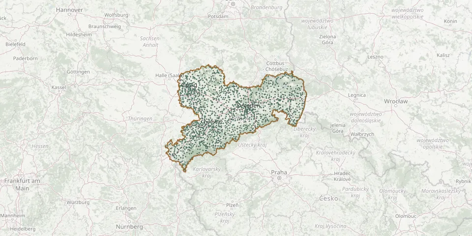 © OpenStreetMap
- St. Michael Cemetery, Wilkau-HaßlauGPS coordinates: 50.66891° N, 12.51078° E
- St. Nicholas Cemetery, BautzenGPS coordinates: 51.18363° N, 14.42267° E
- St. Nicholas Cemetery, ChemnitzGPS coordinates: 50.82498° N, 12.89297° E
- St. Nicholas Cemetery, PlossenGPS coordinates: 51.14983° N, 13.46264° E
- Stollberg CemeteryGPS coordinates: 50.70441° N, 12.77516° E
- Stölpchen CemeteryGPS coordinates: 51.32077° N, 13.78656° E
- Stolpen CemeteryGPS coordinates: 51.04510° N, 14.06922° E
- Stolpen CemeteryGPS coordinates: 51.04830° N, 14.07780° E
- St.Oswald CemeteryGPS coordinates: 50.77449° N, 12.31315° E
- Stötteritz CemeteryGPS coordinates: 51.32356° N, 12.43474° E
- St. Paul Cemetery, DresdenGPS coordinates: 51.08738° N, 13.74128° E
- St. Paul Cemetery, ZwickauGPS coordinates: 50.71458° N, 12.45260° E
- Strand Woodland CemeteryGPS coordinates: 50.93774° N, 14.09305° E
- Straßberg CemeteryGPS coordinates: 50.47668° N, 12.08666° E
- Straßgräbchen CemeteryGPS coordinates: 51.34638° N, 14.07155° E
- Strauch CemeteryGPS coordinates: 51.36619° N, 13.57235° E
- Streckewalde CemeteryGPS coordinates: 50.62464° N, 13.07316° E
- Strehla CemeteryGPS coordinates: 51.35300° N, 13.22360° E
- Strelln CemeteryGPS coordinates: 51.48229° N, 12.78672° E
- Striegnitz CemeteryGPS coordinates: 51.22409° N, 13.28358° E
- Strießen CemeteryGPS coordinates: 51.26122° N, 13.49599° E
- Struppen CemeteryGPS coordinates: 50.93637° N, 14.00977° E
- St. WolfgangGPS coordinates: 51.16539° N, 13.45902° E
- Süptitz Evangelical Church & CemeteryGPS coordinates: 51.56667° N, 12.93061° E
- Syhra Cemetery (Woodland Cemetery)GPS coordinates: 51.03774° N, 12.63963° E
- Syrau CemeteryGPS coordinates: 50.54402° N, 12.07620° E
- Tanneberg CemeteryGPS coordinates: 51.02660° N, 12.96660° E
- Tanneberg CemeteryGPS coordinates: 51.05481° N, 13.41467° E
- Tannenberg CemeteryGPS coordinates: 50.60737° N, 12.94716° E
- Tannenbergsthal CemeteryGPS coordinates: 50.43969° N, 12.46077° E