
Saxony
1,500 known cemeteries in Saxony, Germany.
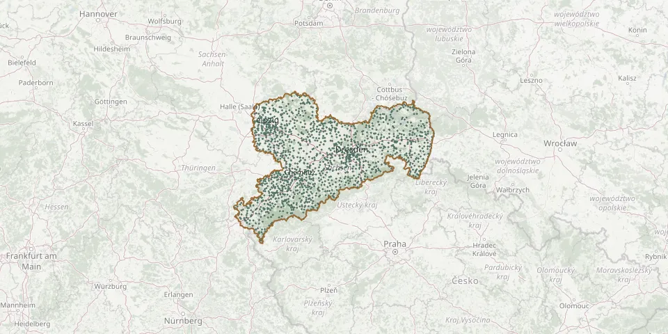 © OpenStreetMap
- Blumberg ChurchyardGPS coordinates: 51.51896° N, 13.18425° E
- Bockelwitz CemeteryGPS coordinates: 51.19934° N, 12.95458° E
- Bockendorf CemeteryGPS coordinates: 50.92724° N, 13.16054° E
- Bockwitz CemeteryGPS coordinates: 51.42317° N, 13.08961° E
- Böhlitz Evangelical CemeteryGPS coordinates: 51.44110° N, 12.75060° E
- Böhrigen Woodland CemeteryGPS coordinates: 51.03260° N, 13.14702° E
- Boritz CemeteryGPS coordinates: 51.27393° N, 13.39928° E
- Börln Evangelical CemeteryGPS coordinates: 51.38150° N, 12.93040° E
- Borna CemeteryGPS coordinates: 50.88162° N, 13.89096° E
- Borna CemeteryGPS coordinates: 51.31397° N, 13.18503° E
- Börnersdorf CemeteryGPS coordinates: 50.82576° N, 13.88084° E
- Börrnichen bei Waldkirchen CemeteryGPS coordinates: 50.74910° N, 13.14230° E
- Borsdorf CemeteryGPS coordinates: 51.34798° N, 12.53902° E
- Börtewitz CemeteryGPS coordinates: 51.21209° N, 12.97850° E
- Boxberg CemeteryGPS coordinates: 51.40873° N, 14.57066° E
- Brand CemeteryGPS coordinates: 51.46599° N, 14.76406° E
- Brand-Erbisdorf CemeteryGPS coordinates: 50.86138° N, 13.32307° E
- Brandis Old CemeteryGPS coordinates: 51.33654° N, 12.60915° E
- Brauna Counts' CemeteryGPS coordinates: 51.27788° N, 14.04038° E
- Bräunsdorf CemeteryGPS coordinates: 50.93610° N, 13.22176° E
- Bräunsdorf CemeteryGPS coordinates: 50.87201° N, 12.69261° E
- Breitenau CemeteryGPS coordinates: 50.80778° N, 13.88994° E
- Breitenborn CemeteryGPS coordinates: 51.02787° N, 12.73427° E
- Breitingen CemeteryGPS coordinates: 51.08372° N, 12.42791° E
- Breßlersches ErbbegräbnisGPS coordinates: 51.16859° N, 14.61927° E
- Bretnig CemeteryGPS coordinates: 51.14941° N, 14.06389° E
- Brinnis CemeteryGPS coordinates: 51.51660° N, 12.44040° E
- Brockau CemeteryGPS coordinates: 50.60464° N, 12.21230° E
- Brockwitz ChurchyardGPS coordinates: 51.13099° N, 13.54319° E
- Brodau CemeteryGPS coordinates: 51.49547° N, 12.34011° E