
Saxony
1,500 known cemeteries in Saxony, Germany.
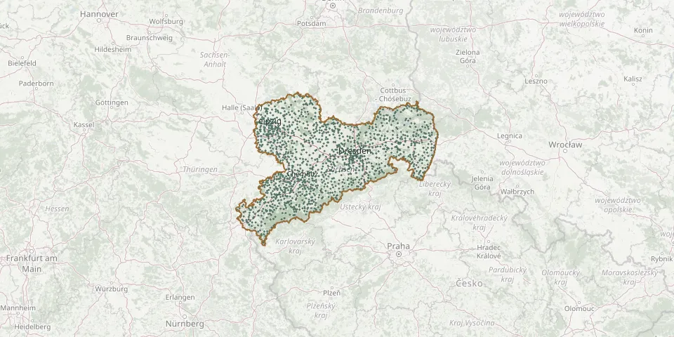 © OpenStreetMap
- Chemnitz St. Michael Church CemeteryGPS coordinates: 50.80019° N, 12.91547° E
- Christophorus-Kirchgemeinde CemeteryGPS coordinates: 51.19541° N, 12.38329° E
- Church of Our Lady Churchyard, MeissenGPS coordinates: 51.16279° N, 13.46171° E
- Chursdorf CemeteryGPS coordinates: 50.92175° N, 12.75025° E
- Clausnitz CemeteryGPS coordinates: 50.74200° N, 13.48831° E
- Claußnitz ChurchyardGPS coordinates: 50.93656° N, 12.88289° E
- Claußnitz New CemeteryGPS coordinates: 50.93901° N, 12.88164° E
- Colditz CemeteryGPS coordinates: 51.12567° N, 12.80481° E
- Collm CemeteryGPS coordinates: 51.30296° N, 13.01857° E
- Colmnitz CemeteryGPS coordinates: 50.90903° N, 13.49474° E
- Colmnitz CemeteryGPS coordinates: 51.33073° N, 13.43384° E
- Community in Christ Jesus Cemetery, MarterbüschelGPS coordinates: 50.70641° N, 13.21113° E
- Conradsdorf CemeteryGPS coordinates: 50.95103° N, 13.38062° E
- Constappel Cemetery (New Cemetery)GPS coordinates: 51.10401° N, 13.56206° E
- Constappel Old CemeteryGPS coordinates: 51.10498° N, 13.56599° E
- Coschütz CemeteryGPS coordinates: 51.01914° N, 13.70815° E
- Cosel CemeteryGPS coordinates: 51.38021° N, 13.94289° E
- Cossebaude Mountain CemeteryGPS coordinates: 51.07899° N, 13.61835° E
- Costewitz CemeteryGPS coordinates: 51.14279° N, 12.23151° E
- Cotta CemeteryGPS coordinates: 50.90385° N, 13.96657° E
- Cotta CemeteryGPS coordinates: 51.05133° N, 13.67085° E
- Cottas Grab unter 80 EichenGPS coordinates: 50.97835° N, 13.57607° E
- Crandorf CemeteryGPS coordinates: 50.51077° N, 12.78643° E
- Cranzahl CemeteryGPS coordinates: 50.51354° N, 12.98748° E
- Crimmitschau CemeteryGPS coordinates: 50.82044° N, 12.37794° E
- Crossen CemeteryGPS coordinates: 51.03230° N, 12.92290° E
- Crossen CemeteryGPS coordinates: 50.75697° N, 12.49699° E
- Crostau CemeteryGPS coordinates: 51.08329° N, 14.45186° E
- Crostwitz CemeteryGPS coordinates: 51.23763° N, 14.24720° E
- Crottendorf CemeteryGPS coordinates: 50.51762° N, 12.94419° E