
Saxony
1,500 known cemeteries in Saxony, Germany.
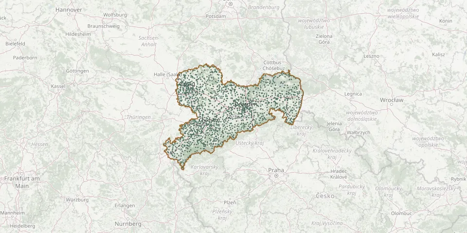 © OpenStreetMap
- Brößnitz CemeteryGPS coordinates: 51.36493° N, 13.65797° E
- Bröthen CemeteryGPS coordinates: 51.42840° N, 14.18712° E
- Brünlos CemeteryGPS coordinates: 50.68600° N, 12.81612° E
- Buchheim CemeteryGPS coordinates: 51.12860° N, 12.66345° E
- Buchholz CemeteryGPS coordinates: 51.19872° N, 14.69480° E
- Bühlau CemeteryGPS coordinates: 51.05858° N, 13.85527° E
- Bulleritz CemeteryGPS coordinates: 51.33401° N, 14.01314° E
- Burg CemeteryGPS coordinates: 51.45647° N, 14.34873° E
- Burgneudorf CemeteryGPS coordinates: 51.49335° N, 14.37347° E
- Burkartshain CemeteryGPS coordinates: 51.32630° N, 12.80496° E
- Burkau CemeteryGPS coordinates: 51.17384° N, 14.16875° E
- Burkersdorf CemeteryGPS coordinates: 50.62585° N, 12.54070° E
- Burkersdorf CemeteryGPS coordinates: 50.82326° N, 13.49116° E
- Burkhardswalde CemeteryGPS coordinates: 51.07417° N, 13.43023° E
- Burkhardswalde CemeteryGPS coordinates: 50.92149° N, 13.85879° E
- Burkhardtsdorf CemeteryGPS coordinates: 50.73635° N, 12.92019° E
- Burkhardtsgrün CemeteryGPS coordinates: 50.53695° N, 12.62175° E
- Cainsdorf CemeteryGPS coordinates: 50.67894° N, 12.49295° E
- Callenberg CemeteryGPS coordinates: 50.84569° N, 12.63875° E
- Cämmerswalde CemeteryGPS coordinates: 50.70877° N, 13.50350° E
- Canitz CemeteryGPS coordinates: 51.31281° N, 13.21831° E
- Carlsfeld CemeteryGPS coordinates: 50.43443° N, 12.59147° E
- Cavertitz Lower CemeteryGPS coordinates: 51.38659° N, 13.13272° E
- Cavertitz Upper CemeteryGPS coordinates: 51.38775° N, 13.13094° E
- Chemnitz Castle CemeteryGPS coordinates: 50.84873° N, 12.91631° E
- Chemnitz Jewish CemeteryGPS coordinates: 50.82880° N, 12.88959° E
- Chemnitz Municipal CemeteryGPS coordinates: 50.81120° N, 12.93148° E
- Chemnitz Municipal Cemetery, WartburgstraßeGPS coordinates: 50.81240° N, 12.93710° E
- Chemnitz-Röhrsdorf CemeteryGPS coordinates: 50.86305° N, 12.83420° E
- Chemnitz Soviet Garrison CemeteryGPS coordinates: 50.80940° N, 12.96148° E