
Thuringia
2,006 known cemeteries in Thuringia, Germany.
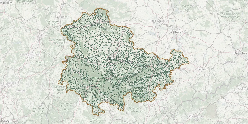 © OpenStreetMap
- Oepfershausen CemeteryGPS coordinates: 50.64239° N, 10.24109° E
- Oesterbehringen Municipal CemeteryGPS coordinates: 51.02419° N, 10.52613° E
- Oettern CemeteryGPS coordinates: 50.92299° N, 11.36109° E
- Oettersdorf CemeteryGPS coordinates: 50.60126° N, 11.81590° E
- Ohrdruf New CemeteryGPS coordinates: 50.83184° N, 10.73256° E
- Olbersleben CemeteryGPS coordinates: 51.14858° N, 11.34018° E
- Old St. John Cemetery, JenaGPS coordinates: 50.93094° N, 11.58252° E
- Ollendorf CemeteryGPS coordinates: 51.03831° N, 11.18527° E
- Öpitz CemeteryGPS coordinates: 50.68984° N, 11.56977° E
- Oppershausen CemeteryGPS coordinates: 51.14047° N, 10.44521° E
- Oppurg CemeteryGPS coordinates: 50.70880° N, 11.65297° E
- Oppurg CemeteryGPS coordinates: 50.71636° N, 11.66994° E
- Orlamünde CemeteryGPS coordinates: 50.77382° N, 11.51463° E
- Orlishausen Cemetery IGPS coordinates: 51.15671° N, 11.18817° E
- Oßla CemeteryGPS coordinates: 50.46235° N, 11.51065° E
- OssmannstedtGPS coordinates: 51.01556° N, 11.42519° E
- Oßmaritz CemeteryGPS coordinates: 50.88155° N, 11.54514° E
- Osterode CemeteryGPS coordinates: 51.56405° N, 10.81630° E
- Osthausen Cemetery, Osthausen-WülfershausenGPS coordinates: 50.85353° N, 11.09897° E
- Ostramondra CemeteryGPS coordinates: 51.19744° N, 11.33108° E
- Ottendorf CemeteryGPS coordinates: 50.82818° N, 11.82394° E
- Ottendorf Upper CemeteryGPS coordinates: 50.82962° N, 11.82975° E
- Ottenhausen Cemetery (Weißensee)GPS coordinates: 51.21362° N, 10.99917° E
- Otterstedt CemeteryGPS coordinates: 51.27162° N, 10.88000° E
- Ottmannshausen CemeteryGPS coordinates: 51.04674° N, 11.25749° E
- Ottstedt am Berge CemeteryGPS coordinates: 51.01915° N, 11.21524° E
- Ottstedt Cemetery (Magdala)GPS coordinates: 50.91198° N, 11.42149° E
- Otzbach Municipal CemeteryGPS coordinates: 50.74038° N, 10.02269° E
- Pahnstangen CemeteryGPS coordinates: 50.61541° N, 11.77571° E
- Pahren CemeteryGPS coordinates: 50.64762° N, 11.89772° E