
Thuringia
2,006 known cemeteries in Thuringia, Germany.
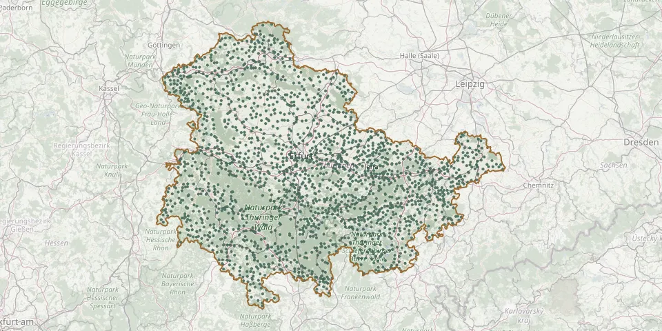 © OpenStreetMap
- Pörmitz CemeteryGPS coordinates: 50.61421° N, 11.81012° E
- Pörsdorf CemeteryGPS coordinates: 50.89552° N, 11.98965° E
- Posen CemeteryGPS coordinates: 50.64303° N, 11.69201° E
- Possendorf CemeteryGPS coordinates: 50.93957° N, 11.31490° E
- Pößneck Upper CemeteryGPS coordinates: 50.68889° N, 11.58710° E
- Posterstein CemeteryGPS coordinates: 50.86452° N, 12.26366° E
- Pottiga CemeteryGPS coordinates: 50.41598° N, 11.74037° E
- Probstzella CemeteryGPS coordinates: 50.53099° N, 11.38238° E
- Prößdorf CemeteryGPS coordinates: 51.08823° N, 12.30814° E
- Pützlingen CemeteryGPS coordinates: 51.52153° N, 10.62247° E
- Quaschwitz CemeteryGPS coordinates: 50.68277° N, 11.70207° E
- Queienfeld CemeteryGPS coordinates: 50.45001° N, 10.45865° E
- Quirla CemeteryGPS coordinates: 50.86553° N, 11.76357° E
- Quittelsdorf CemeteryGPS coordinates: 50.69301° N, 11.19892° E
- Rabenäußig CemeteryGPS coordinates: 50.40052° N, 11.09137° E
- Rabis CemeteryGPS coordinates: 50.89369° N, 11.67139° E
- Raila CemeteryGPS coordinates: 50.51949° N, 11.79109° E
- Raitzhain CemeteryGPS coordinates: 50.86528° N, 12.20604° E
- Ramsla CemeteryGPS coordinates: 51.05134° N, 11.28899° E
- Ranis CemeteryGPS coordinates: 50.66120° N, 11.56030° E
- Rasephas CemeteryGPS coordinates: 51.00386° N, 12.44365° E
- Rastenberg New CemeteryGPS coordinates: 51.17210° N, 11.42388° E
- Rastenberg Woodland CemeteryGPS coordinates: 51.17278° N, 11.42529° E
- Rauda CemeteryGPS coordinates: 50.95408° N, 11.94285° E
- Rauenstein Cemetery (Frankenblick)GPS coordinates: 50.41709° N, 11.04368° E
- Rauschwitz CemeteryGPS coordinates: 50.97124° N, 11.79957° E
- Rausdorf CemeteryGPS coordinates: 50.85808° N, 11.68803° E
- Rehestädt CemeteryGPS coordinates: 50.86818° N, 10.92346° E
- Rehmen CemeteryGPS coordinates: 50.71197° N, 11.62603° E
- Reichardtsdorf CemeteryGPS coordinates: 50.91935° N, 11.97239° E