
Thuringia
2,006 known cemeteries in Thuringia, Germany.
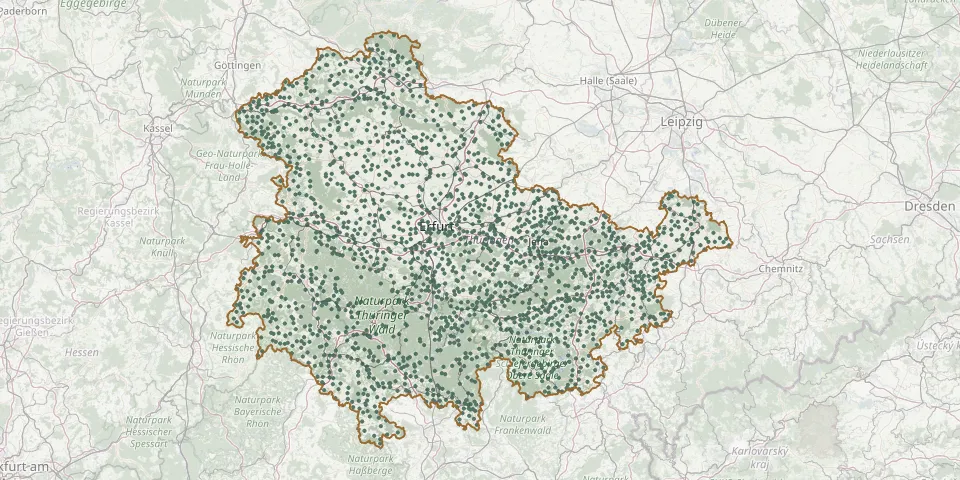 © OpenStreetMap
- Ringleben CemeteryGPS coordinates: 51.10480° N, 10.94864° E
- Ringleben CemeteryGPS coordinates: 51.36740° N, 11.22673° E
- Rippershausen CemeteryGPS coordinates: 50.60552° N, 10.34658° E
- Rippersroda CemeteryGPS coordinates: 50.75757° N, 10.87355° E
- Ritschenhausen CemeteryGPS coordinates: 50.50869° N, 10.43190° E
- Rittersdorf Cemetery, ThüringenGPS coordinates: 50.81811° N, 11.23661° E
- Roben CemeteryGPS coordinates: 50.94122° N, 12.05424° E
- Röblitz CemeteryGPS coordinates: 50.66278° N, 11.42178° E
- Rockau Cemetery (Schkölen)GPS coordinates: 50.99270° N, 11.76296° E
- Rockendorf CemeteryGPS coordinates: 50.67021° N, 11.51891° E
- Rockensußra CemeteryGPS coordinates: 51.27051° N, 10.70377° E
- Rockhausen CemeteryGPS coordinates: 50.90040° N, 11.03970° E
- Rockstedt CemeteryGPS coordinates: 51.28670° N, 10.76031° E
- Roda CemeteryGPS coordinates: 50.78585° N, 11.01414° E
- Rodameuschel CemeteryGPS coordinates: 51.04285° N, 11.71603° E
- Rödelwitz CemeteryGPS coordinates: 50.78176° N, 11.43017° E
- Rodias CemeteryGPS coordinates: 50.83893° N, 11.51261° E
- Rödichen Woodland CemeteryGPS coordinates: 50.88296° N, 10.58070° E
- Rodigast CemeteryGPS coordinates: 50.93775° N, 11.71631° E
- Rödigen CemeteryGPS coordinates: 50.98062° N, 11.60240° E
- Rodishain CemeteryGPS coordinates: 51.53780° N, 10.91983° E
- Rohda CemeteryGPS coordinates: 50.94523° N, 11.12697° E
- Rohna CemeteryGPS coordinates: 50.75291° N, 11.98186° E
- Rohrbach CemeteryGPS coordinates: 51.06860° N, 11.39914° E
- Rohrberg CemeteryGPS coordinates: 51.40829° N, 10.02048° E
- Rohrborn CemeteryGPS coordinates: 51.14057° N, 11.15597° E
- Roldisleben CemeteryGPS coordinates: 51.17641° N, 11.38048° E
- Römhild CemeteryGPS coordinates: 50.39762° N, 10.53737° E
- Röppisch CemeteryGPS coordinates: 50.50791° N, 11.67981° E
- Rosa CemeteryGPS coordinates: 50.71219° N, 10.25270° E