
Thuringia
2,006 known cemeteries in Thuringia, Germany.
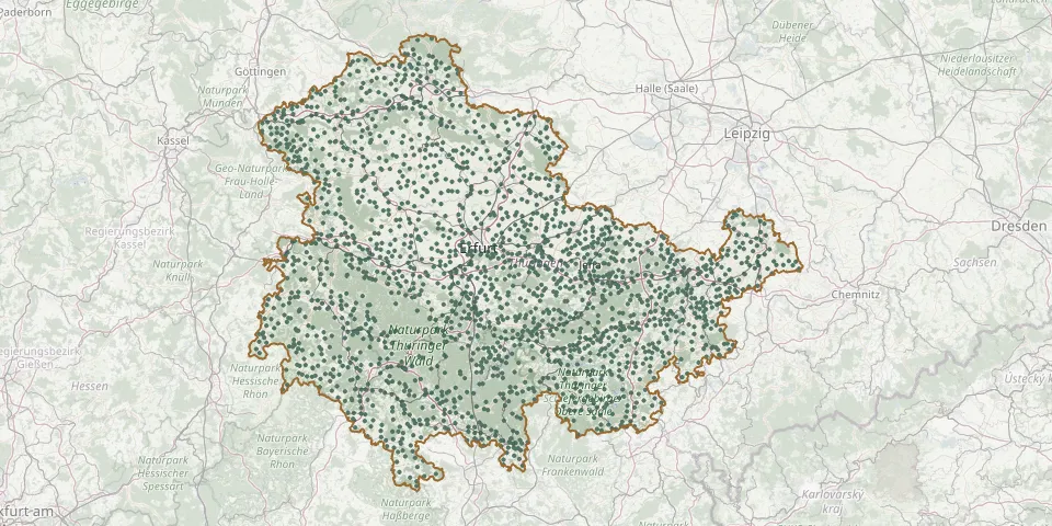 © OpenStreetMap
- Beutelsdorf Cemetery (Uhlstädt-Kirchhasel)GPS coordinates: 50.75966° N, 11.48644° E
- Beutnitz CemeteryGPS coordinates: 50.97213° N, 11.67675° E
- Biberschlag CemeteryGPS coordinates: 50.49455° N, 10.86457° E
- Bibra Cemetery (Grabfeld)GPS coordinates: 50.47140° N, 10.43807° E
- Bickenriede CemeteryGPS coordinates: 51.25342° N, 10.34880° E
- Bielen CemeteryGPS coordinates: 51.48582° N, 10.84611° E
- Bienstädt CemeteryGPS coordinates: 51.01706° N, 10.85150° E
- Bilzingsleben CemeteryGPS coordinates: 51.28494° N, 11.07111° E
- Bindersleben CemeteryGPS coordinates: 50.97156° N, 10.95368° E
- Birkenfeld Cemetery (Hildburghausen)GPS coordinates: 50.41746° N, 10.73691° E
- Birkenfelde CemeteryGPS coordinates: 51.35611° N, 10.01516° E
- Birkenhügel CemeteryGPS coordinates: 50.42777° N, 11.74817° E
- Birkhausen CemeteryGPS coordinates: 50.77975° N, 11.91552° E
- Birkigt Cemetery (Unterwellenborn)GPS coordinates: 50.67009° N, 11.48398° E
- Birkungen CemeteryGPS coordinates: 51.36278° N, 10.33566° E
- Birnbaum War CemeteryGPS coordinates: 50.84364° N, 10.74147° E
- Birx CemeteryGPS coordinates: 50.53026° N, 10.04592° E
- Bischhagen CemeteryGPS coordinates: 51.42610° N, 10.09433° E
- Bischleben CemeteryGPS coordinates: 50.93514° N, 10.98995° E
- Bischofferode CemeteryGPS coordinates: 51.49635° N, 10.45029° E
- Bischofroda Municipal CemeteryGPS coordinates: 51.05607° N, 10.36042° E
- Bischofrod CemeteryGPS coordinates: 50.53837° N, 10.66330° E
- Bittstädt CemeteryGPS coordinates: 50.83404° N, 10.88937° E
- Blankenburg CemeteryGPS coordinates: 51.20502° N, 10.74864° E
- Blankenstein CemeteryGPS coordinates: 50.40477° N, 11.69742° E
- Blechhammer CemeteryGPS coordinates: 50.39804° N, 11.20034° E
- Bleckenrode CemeteryGPS coordinates: 51.46660° N, 10.21690° E
- Bleicherode CemeteryGPS coordinates: 51.43917° N, 10.57945° E
- Bleicherode Jewish CemeteryGPS coordinates: 51.43398° N, 10.57084° E
- Bliedungen CemeteryGPS coordinates: 51.49355° N, 10.58989° E