
Thuringia
2,006 known cemeteries in Thuringia, Germany.
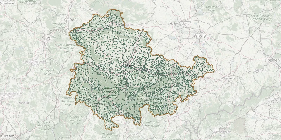 © OpenStreetMap
- Blintendorf CemeteryGPS coordinates: 50.44569° N, 11.80763° E
- Bobeck CemeteryGPS coordinates: 50.90146° N, 11.79616° E
- Bockelnhagen CemeteryGPS coordinates: 51.56646° N, 10.42450° E
- Bodelwitz CemeteryGPS coordinates: 50.68754° N, 11.62440° E
- Bodenrode CemeteryGPS coordinates: 51.39869° N, 10.21329° E
- Böhlen Cemetery, GroßbreitenbachGPS coordinates: 50.58580° N, 11.04177° E
- Böhlscheiben CemeteryGPS coordinates: 50.67321° N, 11.23569° E
- Boilstädt CemeteryGPS coordinates: 50.91862° N, 10.68623° E
- Bollberg CemeteryGPS coordinates: 50.88114° N, 11.79492° E
- Bolleroda CemeteryGPS coordinates: 51.01853° N, 10.39733° E
- Bornhagen CemeteryGPS coordinates: 51.34630° N, 9.94340° E
- Borsch Cemetery (Geisa)GPS coordinates: 50.73287° N, 9.96539° E
- Börthen CemeteryGPS coordinates: 50.74196° N, 11.73930° E
- Borxleben CemeteryGPS coordinates: 51.39545° N, 11.23158° E
- Böseckendorf CemeteryGPS coordinates: 51.47520° N, 10.19750° E
- Bösleben CemeteryGPS coordinates: 50.82855° N, 11.06096° E
- Bothenheilingen CemeteryGPS coordinates: 51.18516° N, 10.62479° E
- Bottendorf CemeteryGPS coordinates: 51.30719° N, 11.40113° E
- Brahmenau CemeteryGPS coordinates: 50.91935° N, 12.15643° E
- Branchewinda CemeteryGPS coordinates: 50.78681° N, 10.99325° E
- Brattendorf CemeteryGPS coordinates: 50.46612° N, 10.85735° E
- Braunichswalde CemeteryGPS coordinates: 50.79949° N, 12.22146° E
- Braunsdorf Cemetery, Auma-WeidatalGPS coordinates: 50.73413° N, 11.91324° E
- Brehme CemeteryGPS coordinates: 51.49475° N, 10.34496° E
- Breitenbach Cemetery, SchmalkaldenGPS coordinates: 50.69000° N, 10.49177° E
- Breitenhain CemeteryGPS coordinates: 51.08315° N, 12.31942° E
- Breitenhain CemeteryGPS coordinates: 50.77306° N, 11.73386° E
- Breitenholz CemeteryGPS coordinates: 51.38626° N, 10.36090° E
- Breitenworbis CemeteryGPS coordinates: 51.41035° N, 10.42150° E
- Breitungen/Werra CemeteryGPS coordinates: 50.75691° N, 10.34411° E