
Thuringia
2,006 known cemeteries in Thuringia, Germany.
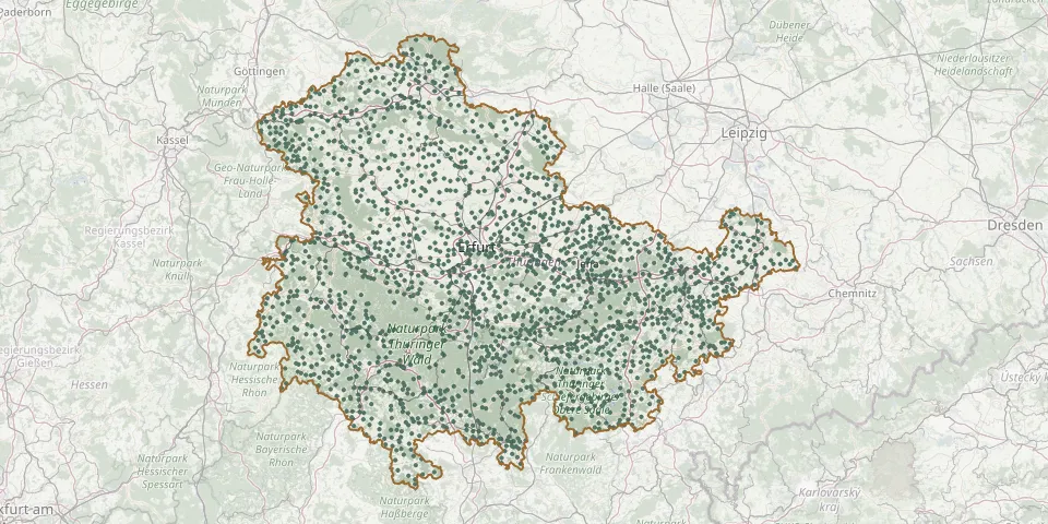 © OpenStreetMap
- Büttstedt CemeteryGPS coordinates: 51.26010° N, 10.30820° E
- Caaschwitz CemeteryGPS coordinates: 50.94491° N, 11.99022° E
- Cabarz CemeteryGPS coordinates: 50.87999° N, 10.49514° E
- Camburg CemeteryGPS coordinates: 51.05713° N, 11.70520° E
- Caselwitz New CemeteryGPS coordinates: 50.63492° N, 12.16866° E
- Catharinau CemeteryGPS coordinates: 50.71669° N, 11.38784° E
- Cemetery Hermannsfeld (Rhönblick)GPS coordinates: 50.50387° N, 10.32304° E
- Cemetery LiebschützGPS coordinates: 50.57352° N, 11.64675° E
- Cemetery NiederkrossenGPS coordinates: 50.75989° N, 11.52581° E
- Cemetery SiegmundsburgGPS coordinates: 50.46818° N, 11.05574° E
- Cemetery St. Petri StraußfurtGPS coordinates: 51.16261° N, 10.99344° E
- Cemetery TrebraGPS coordinates: 51.28536° N, 10.97610° E
- Christes CemeteryGPS coordinates: 50.66463° N, 10.48198° E
- Chursdorf CemeteryGPS coordinates: 50.66383° N, 11.85499° E
- Clingen CemeteryGPS coordinates: 51.23204° N, 10.93570° E
- Clodra CemeteryGPS coordinates: 50.75871° N, 12.12195° E
- Closewitz CemeteryGPS coordinates: 50.95850° N, 11.57405° E
- Cobstädt CemeteryGPS coordinates: 50.92402° N, 10.83499° E
- Concordia Mountain CemeteryGPS coordinates: 50.89029° N, 10.36710° E
- Coppanz CemeteryGPS coordinates: 50.90018° N, 11.53811° E
- Cordobang CemeteryGPS coordinates: 50.67034° N, 11.20721° E
- Cospeda CemeteryGPS coordinates: 50.94757° N, 11.55717° E
- Cottendorf CemeteryGPS coordinates: 50.73453° N, 11.02647° E
- Craimar Cemetery (Breitungen / Werra)GPS coordinates: 50.75846° N, 10.30637° E
- Craula Municipal CemeteryGPS coordinates: 51.06643° N, 10.49155° E
- Crawinkel CemeteryGPS coordinates: 50.78349° N, 10.79179° E
- Creuzburg CemeteryGPS coordinates: 51.05735° N, 10.24813° E
- Crispendorf CemeteryGPS coordinates: 50.59079° N, 11.73299° E
- Crock CemeteryGPS coordinates: 50.45777° N, 10.88302° E
- Crossen CemeteryGPS coordinates: 50.97245° N, 11.97469° E