
Zala
329 known cemeteries in Zala, Hungary.
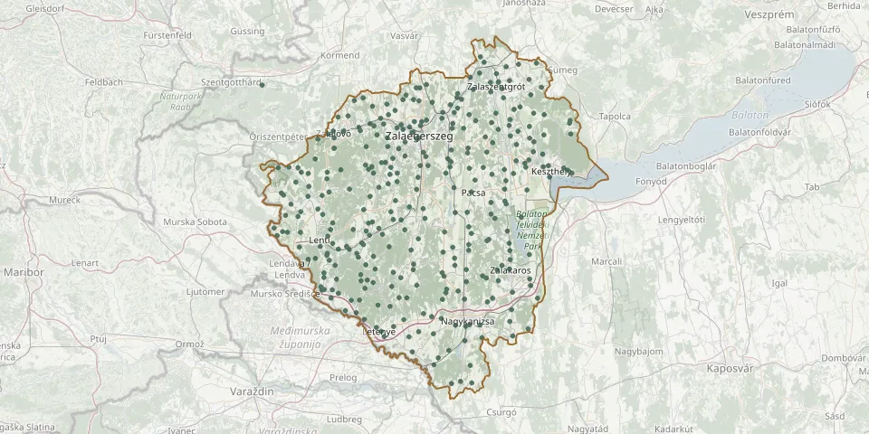 © OpenStreetMap
- Fő Road Cemetery, IklódbördőceGPS coordinates: 46.60556° N, 16.59920° E
- Fűzvölgy CemeteryGPS coordinates: 46.52157° N, 16.92797° E
- Gáborjánháza CemeteryGPS coordinates: 46.63343° N, 16.41374° E
- Garabonc CemeteryGPS coordinates: 46.58345° N, 17.12056° E
- Gazdaság Street Cemetery, ZalaegerszegGPS coordinates: 46.86488° N, 16.78983° E
- Gébárt CemeteryGPS coordinates: 46.85978° N, 16.81507° E
- Gellénháza CemeteryGPS coordinates: 46.76358° N, 16.77759° E
- Gelse CemeteryGPS coordinates: 46.60310° N, 16.99463° E
- Gelse Jewish CemeteryGPS coordinates: 46.61476° N, 16.99470° E
- Gétye CemeteryGPS coordinates: 46.76107° N, 17.06514° E
- Görbő CemeteryGPS coordinates: 46.66710° N, 16.76577° E
- Gosztola CemeteryGPS coordinates: 46.58614° N, 16.52961° E
- Gutorfölde CemeteryGPS coordinates: 46.63654° N, 16.73267° E
- Gyűrűs CemeteryGPS coordinates: 46.88500° N, 16.99603° E
- Hagyárosbörönd CemeteryGPS coordinates: 46.90289° N, 16.70294° E
- Hahót CemeteryGPS coordinates: 46.64103° N, 16.92208° E
- Hernyék CemeteryGPS coordinates: 46.64654° N, 16.64414° E
- Homokkomárom CemeteryGPS coordinates: 46.50048° N, 16.91491° E
- Hosszúvölgy CemeteryGPS coordinates: 46.51409° N, 16.92572° E
- Hottó CemeteryGPS coordinates: 46.83715° N, 16.74807° E
- Hunyadi János utca Cemetery, ZalaszentlászlóGPS coordinates: 46.86292° N, 17.11735° E
- Irsapuszta CemeteryGPS coordinates: 46.81528° N, 16.58706° E
- Jewish cemetery, Karmacsi AlsómajorGPS coordinates: 46.82919° N, 17.19282° E
- Kacorlak CemeteryGPS coordinates: 46.57134° N, 16.95268° E
- Kallósd CemeteryGPS coordinates: 46.86904° N, 17.06484° E
- Kálócfa CemeteryGPS coordinates: 46.75171° N, 16.56427° E
- Kányavár CemeteryGPS coordinates: 46.57240° N, 16.68304° E
- Karmacs CemeteryGPS coordinates: 46.83609° N, 17.17999° E
- Kávás CemeteryGPS coordinates: 46.86193° N, 16.70702° E
- Kehida CemeteryGPS coordinates: 46.85482° N, 17.08456° E