
Zala
329 known cemeteries in Zala, Hungary.
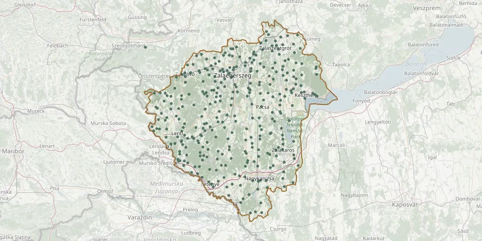 © OpenStreetMap
- Kossuth Lajos Street Cemetery, ZalalövőGPS coordinates: 46.85106° N, 16.61389° E
- Kossuth Lajos út Cemetery, BecsehelyGPS coordinates: 46.44356° N, 16.76739° E
- Kozmadombja CemeteryGPS coordinates: 46.76546° N, 16.56531° E
- Kustánszeg CemeteryGPS coordinates: 46.78042° N, 16.68151° E
- Kustány CemeteryGPS coordinates: 46.84116° N, 17.12141° E
- Lakhegy CemeteryGPS coordinates: 46.94085° N, 16.83584° E
- Lasztonya CemeteryGPS coordinates: 46.56409° N, 16.71143° E
- Lendvadedes CemeteryGPS coordinates: 46.58385° N, 16.50820° E
- Lendvajakabfa CemeteryGPS coordinates: 46.67587° N, 16.43901° E
- Lenti CemeteryGPS coordinates: 46.59245° N, 16.56456° E
- Lenti CemeteryGPS coordinates: 46.61108° N, 16.54458° E
- Lenti-Mumor CemeteryGPS coordinates: 46.63232° N, 16.56712° E
- Lentiszombathely CemeteryGPS coordinates: 46.61731° N, 16.58208° E
- Letenye CemeteryGPS coordinates: 46.43351° N, 16.72904° E
- Letenye Former Jewish CemeteryGPS coordinates: 46.44182° N, 16.71494° E
- Lickóvadamos CemeteryGPS coordinates: 46.74589° N, 16.77786° E
- Ligetfalva CemeteryGPS coordinates: 46.82699° N, 17.06683° E
- Lispe CemeteryGPS coordinates: 46.53560° N, 16.70481° E
- Liszó CemeteryGPS coordinates: 46.36219° N, 16.99938° E
- Lovászi CemeteryGPS coordinates: 46.54597° N, 16.55567° E
- Lovászi Old CemeteryGPS coordinates: 46.55577° N, 16.55566° E
- Magyarföld CemeteryGPS coordinates: 46.77469° N, 16.41736° E
- Magyarszerdahely CemeteryGPS coordinates: 46.54860° N, 16.91980° E
- Máhomfa CemeteryGPS coordinates: 46.59647° N, 16.56512° E
- Maróc CemeteryGPS coordinates: 46.55170° N, 16.66725° E
- Maróc New CemeteryGPS coordinates: 46.53905° N, 16.66786° E
- Márokföld CemeteryGPS coordinates: 46.71811° N, 16.43307° E
- Miháld CemeteryGPS coordinates: 46.45400° N, 17.11933° E
- Mikefa CemeteryGPS coordinates: 46.66210° N, 16.70273° E
- Miklósfa CemeteryGPS coordinates: 46.41395° N, 16.98290° E