
Michoacán
108 known cemeteries in Michoacán, Mexico.
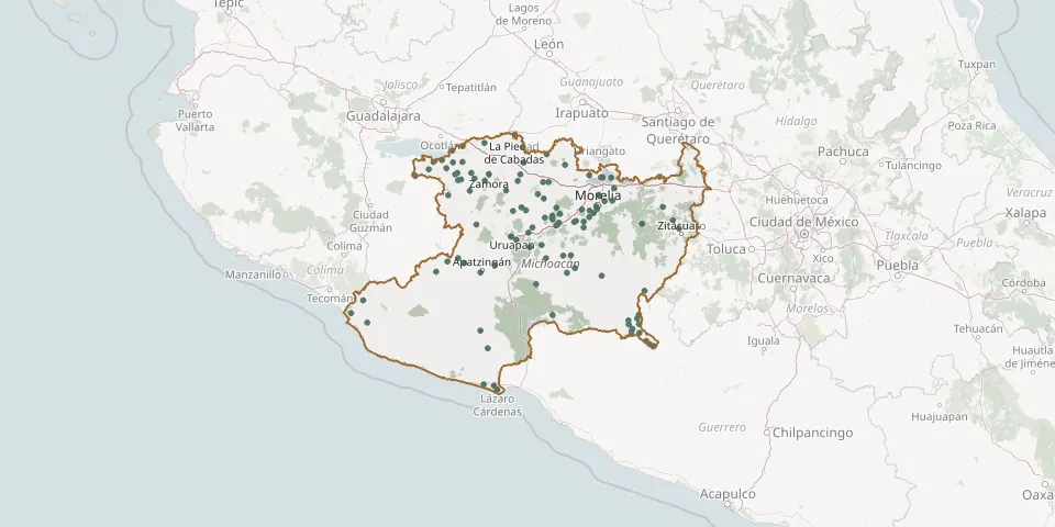 © OpenStreetMap
- Tarímbaro Municipal CemeteryGPS coordinates: 19.79488° N, 101.18202° W
- Tarímbaro New CemeteryGPS coordinates: 19.80312° N, 101.18868° W
- Tecario CemeteryGPS coordinates: 19.23042° N, 101.54149° W
- Tecuena Island CemeteryGPS coordinates: 19.58576° N, 101.65177° W
- Tenencia Morelos CemeteryGPS coordinates: 19.63163° N, 101.23828° W
- Tingambato Municipal CemeteryGPS coordinates: 19.49735° N, 101.84907° W
- Tiquicheo Municipal CemeteryGPS coordinates: 18.90022° N, 100.73110° W
- Tiríndaro CemeteryGPS coordinates: 19.76991° N, 101.73548° W
- Tiripetío CemeteryGPS coordinates: 19.55168° N, 101.33833° W
- Tomendán Municipal CemeteryGPS coordinates: 19.31211° N, 101.87638° W
- Tumbiscatío Municipal CemeteryGPS coordinates: 18.52290° N, 102.36994° W
- Tuxpan Municipal CemeteryGPS coordinates: 19.56767° N, 100.44721° W
- Tzintzuntzan CemeteryGPS coordinates: 19.62461° N, 101.57686° W
- Tzirizicuaro CemeteryGPS coordinates: 18.49122° N, 100.86259° W
- Tzurumútaro Community CemeteryGPS coordinates: 19.54345° N, 101.58583° W
- Villa Jiménez Civil Municipal CemeteryGPS coordinates: 19.92687° N, 101.74614° W
- Villamar Municipal CemeteryGPS coordinates: 20.01281° N, 102.60308° W
- Zacapu Municipal CemeteryGPS coordinates: 19.81051° N, 101.79670° W