
Drenthe
148 known cemeteries in Drenthe, Netherlands.
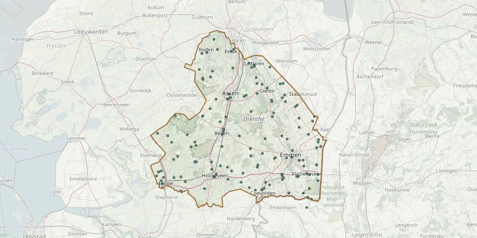 © OpenStreetMap
- Dwingeloo Jewish CemeteryGPS coordinates: 52.82087° N, 6.37047° E
- Eext CemeteryGPS coordinates: 53.02480° N, 6.73510° E
- Emmen CemeteryGPS coordinates: 52.78160° N, 6.90040° E
- Emmen CemeteryGPS coordinates: 52.77113° N, 6.96281° E
- Emmen Jewish CemeteryGPS coordinates: 52.77930° N, 6.87001° E
- Emmen Natural Burial GroundGPS coordinates: 52.76992° N, 6.94136° E
- Emmer-Compascuum CemeteryGPS coordinates: 52.81692° N, 7.05987° E
- Emmer-Compascuum General CemeteryGPS coordinates: 52.81320° N, 7.03800° E
- Engeland Jewish CemeteryGPS coordinates: 52.76545° N, 6.37238° E
- Engeland South CemeteryGPS coordinates: 52.76514° N, 6.36528° E
- Erica Roman Catholic CemeteryGPS coordinates: 52.71695° N, 6.93562° E
- Eursingerhof CemeteryGPS coordinates: 52.87591° N, 6.52243° E
- Familiegraf Westra van HoltheGPS coordinates: 52.81609° N, 6.34315° E
- Gasselte CemeteryGPS coordinates: 52.96720° N, 6.78950° E
- Geallieerd erehofGPS coordinates: 52.75155° N, 6.96604° E
- Geesbrug General CemeteryGPS coordinates: 52.72799° N, 6.62904° E
- Gieten General CemeteryGPS coordinates: 53.01199° N, 6.76256° E
- Gieterveen Broek CemeteryGPS coordinates: 53.02650° N, 6.83530° E
- Gieterveen New CemeteryGPS coordinates: 53.02810° N, 6.85060° E
- Grolloo CemeteryGPS coordinates: 52.93425° N, 6.67506° E
- Havelte CemeteryGPS coordinates: 52.77396° N, 6.24694° E
- Havenstraat CemeteryGPS coordinates: 52.71689° N, 6.92817° E
- Hesselingen Roman Catholic CemeteryGPS coordinates: 52.69286° N, 6.18335° E
- Hijken CemeteryGPS coordinates: 52.90030° N, 6.50420° E
- Hillig Meer Natural Burial GroundGPS coordinates: 52.99435° N, 6.70832° E
- Hollandscheveld CemeteryGPS coordinates: 52.70750° N, 6.54710° E
- Hoofdstraat Old CemeteryGPS coordinates: 52.97990° N, 6.84780° E
- Hoogersmilde CemeteryGPS coordinates: 52.91990° N, 6.40833° E
- Hoogeveen New Jewish CemeteryGPS coordinates: 52.71700° N, 6.47082° E
- Hoogeveen Old Jewish CemeteryGPS coordinates: 52.72539° N, 6.48172° E