
Drenthe
148 known cemeteries in Drenthe, Netherlands.
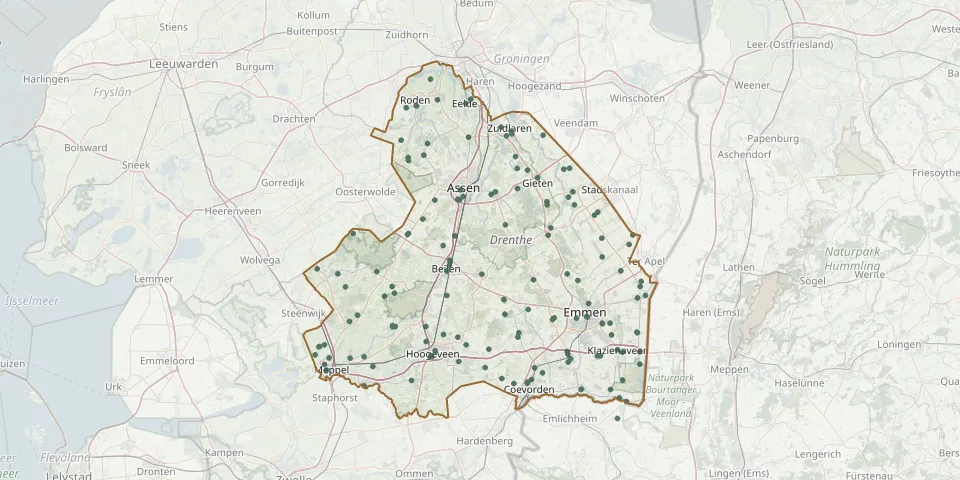 © OpenStreetMap
- Schoonoord CemeteryGPS coordinates: 52.84300° N, 6.75160° E
- Sleen General CemeteryGPS coordinates: 52.77732° N, 6.80458° E
- Sleen Jewish CemeteryGPS coordinates: 52.77993° N, 6.80896° E
- Smilde Hoogersmilde General CemeteryGPS coordinates: 52.94392° N, 6.44762° E
- Steenwijksmoer CemeteryGPS coordinates: 52.67106° N, 6.69788° E
- Stuifzand CemeteryGPS coordinates: 52.75258° N, 6.50511° E
- Tiendeveen CemeteryGPS coordinates: 52.74821° N, 6.54446° E
- Tweede Exloërmond CemeteryGPS coordinates: 52.91215° N, 6.94009° E
- Uffelte CemeteryGPS coordinates: 52.78472° N, 6.26831° E
- Urnenveld AnlooGPS coordinates: 53.02764° N, 6.70720° E
- Valthermond Oost CemeteryGPS coordinates: 52.90149° N, 7.01436° E
- Veenhuizen Jewish CemeteryGPS coordinates: 53.04543° N, 6.40807° E
- Veenoord Jewish CemeteryGPS coordinates: 52.72394° N, 6.84437° E
- Vledder General CemeteryGPS coordinates: 52.85330° N, 6.21430° E
- Wapserouwenweg 2A CemeteryGPS coordinates: 52.83140° N, 6.23580° E
- Weiteveen General CemeteryGPS coordinates: 52.61242° N, 6.98309° E
- Wijster General CemeteryGPS coordinates: 52.81690° N, 6.51370° E
- Wilhelminaoord General CemeteryGPS coordinates: 52.86129° N, 6.15756° E
- Witteveen Communal CemeteryGPS coordinates: 52.81062° N, 6.67059° E
- Witteveen Natural Burial GroundGPS coordinates: 52.81004° N, 6.67091° E
- Zandberg Roman Catholic CemeteryGPS coordinates: 52.91790° N, 7.02510° E
- Zorgvlied CemeteryGPS coordinates: 52.91990° N, 6.25660° E
- Zuiderweg CemeteryGPS coordinates: 52.71534° N, 6.47262° E
- Zuidlaren Jewish CemeteryGPS coordinates: 53.09544° N, 6.66355° E
- Zuidwolde CemeteryGPS coordinates: 52.67580° N, 6.41670° E
- Zwartemeer General CemeteryGPS coordinates: 52.72360° N, 7.04443° E
- Zwartemeer Roman Catholic CemeteryGPS coordinates: 52.70303° N, 7.04372° E
- Zweeloo General CemeteryGPS coordinates: 52.79403° N, 6.73744° E