
Drenthe
148 known cemeteries in Drenthe, Netherlands.
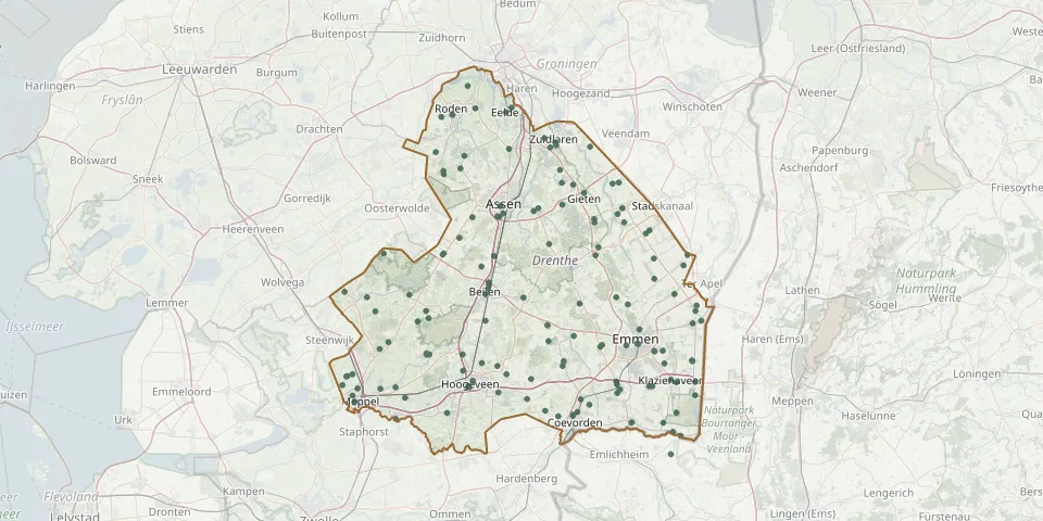 © OpenStreetMap
- Hoogveen Churchyard, Barger-CompascuumGPS coordinates: 52.75559° N, 7.03698° E
- Jewish CemeteryGPS coordinates: 52.91855° N, 6.40580° E
- Kerkenveld Cemetery, SmildeGPS coordinates: 52.94365° N, 6.44832° E
- Klazienaveen CemeteryGPS coordinates: 52.72310° N, 6.99642° E
- Koekange CemeteryGPS coordinates: 52.69895° N, 6.31029° E
- Kolderveen Reformed CemeteryGPS coordinates: 52.71830° N, 6.15250° E
- Meppel General CemeteryGPS coordinates: 52.70224° N, 6.17761° E
- Meppel Jewish CemeteryGPS coordinates: 52.71367° N, 6.19047° E
- Mepperdennen Natural Burial GroundGPS coordinates: 52.78636° N, 6.67283° E
- Nieuw-Amsterdam Old Municipal CemeteryGPS coordinates: 52.71944° N, 6.84599° E
- Nieuw-Buinen CemeteryGPS coordinates: 52.95030° N, 6.91930° E
- Nieuweroord General CemeteryGPS coordinates: 52.73521° N, 6.56692° E
- Nieuwlande CemeteryGPS coordinates: 52.69721° N, 6.61937° E
- Nieuw-Schoonebeek Roman Catholic CemeteryGPS coordinates: 52.64717° N, 6.98821° E
- Nieuw Weerdinge General CemeteryGPS coordinates: 52.85823° N, 6.99217° E
- Nijeveen General CemeteryGPS coordinates: 52.73211° N, 6.16229° E
- Nijeveen Gereformeerd ChurchyardGPS coordinates: 52.73248° N, 6.16395° E
- Nijeveen Reformed CemeteryGPS coordinates: 52.73510° N, 6.17780° E
- Noord CemeteryGPS coordinates: 52.76703° N, 6.36518° E
- Odoorn CemeteryGPS coordinates: 52.85320° N, 6.84430° E
- Oeverse BosGPS coordinates: 52.77132° N, 6.94084° E
- O.L.V. Koningin van de Vrede ChurchyardGPS coordinates: 52.67626° N, 6.99681° E
- Oosterhesselen General CemeteryGPS coordinates: 52.75522° N, 6.71182° E
- Oosterhesselen Jewish CemeteryGPS coordinates: 52.74807° N, 6.70884° E
- Pesse General CemeteryGPS coordinates: 52.76545° N, 6.45586° E
- Riyad Al JannahGPS coordinates: 53.08729° N, 6.69180° E
- Rolde CemeteryGPS coordinates: 52.98914° N, 6.64795° E
- Roswinkel General CemeteryGPS coordinates: 52.84040° N, 7.04800° E
- Roswinkel Old Jewish CemeteryGPS coordinates: 52.83196° N, 7.04480° E
- Ruinen Municipal CemeteryGPS coordinates: 52.76717° N, 6.36491° E