
Friesland
369 known cemeteries in Friesland, Netherlands.
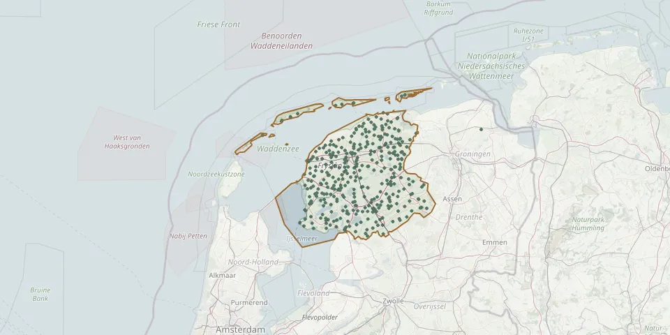 © OpenStreetMap
- Snikzwaag CemeteryGPS coordinates: 52.98243° N, 5.79129° E
- Sondel ChurchyardGPS coordinates: 52.87110° N, 5.59830° E
- Sonnega CemeteryGPS coordinates: 52.86986° N, 5.97381° E
- Staveren General CemeteryGPS coordinates: 52.88209° N, 5.36005° E
- St. Bartholomew Churchyard, WesthemGPS coordinates: 53.01760° N, 5.55030° E
- St. Gertudiskerk ChurchyardGPS coordinates: 53.14800° N, 5.48330° E
- Stiens Protestant ChurchyardGPS coordinates: 53.26248° N, 5.75729° E
- St. Remigius KerkGPS coordinates: 53.14330° N, 5.60740° E
- Stryper Churchyard, MidslandGPS coordinates: 53.37933° N, 5.28382° E
- St. Stephen Churchyard, MenaldumadeelGPS coordinates: 53.20226° N, 5.61795° E
- St. Vitus Churchyard, BlauwhuisGPS coordinates: 53.02288° N, 5.53397° E
- St. Werenfrid Roman Catholic Churchyard, WorkumGPS coordinates: 52.98489° N, 5.44681° E
- Sumar Dutch Reformed Church CemeteryGPS coordinates: 53.17820° N, 6.00260° E
- Surhuisterveen General CemeteryGPS coordinates: 53.18518° N, 6.15926° E
- Surhuizum General CemeteryGPS coordinates: 53.20580° N, 6.18210° E
- Surhuizum Village Church CemeteryGPS coordinates: 53.20600° N, 6.17720° E
- Tacozijl Jewish CemeteryGPS coordinates: 52.86320° N, 5.64517° E
- Terband CemeteryGPS coordinates: 52.97849° N, 5.91894° E
- Terherne CemeteryGPS coordinates: 53.04010° N, 5.78440° E
- Terkaple Churchyard and Two Gravestones in ChurchGPS coordinates: 53.02043° N, 5.78493° E
- Ternaard CemeteryGPS coordinates: 53.38220° N, 5.96080° E
- Teroele Public CemeteryGPS coordinates: 52.93957° N, 5.69737° E
- Tersoal St. Vitus Church CemeteryGPS coordinates: 53.07450° N, 5.73600° E
- Terwispel CemeteryGPS coordinates: 53.01895° N, 6.03816° E
- Terwisscha CemeteryGPS coordinates: 52.95318° N, 6.30673° E
- Tietjerksteraddel (Bergum) Protestant ChurchyardGPS coordinates: 53.19585° N, 6.00163° E
- Tietjerksteradeel Dutch Reformed ChurchyardGPS coordinates: 53.17919° N, 5.92730° E
- Tijnje CemeteryGPS coordinates: 53.02910° N, 5.99350° E
- Tillebuorren CemeteryGPS coordinates: 53.21170° N, 6.09200° E
- Tirns ChurchyardGPS coordinates: 53.05898° N, 5.62609° E