
Friesland
369 known cemeteries in Friesland, Netherlands.
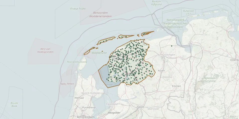 © OpenStreetMap
- Rottefalle General CemeteryGPS coordinates: 53.14710° N, 6.11000° E
- Rottevalle Dutch Reformed Church ChurchyardGPS coordinates: 53.14630° N, 6.10560° E
- Rottum CemeteryGPS coordinates: 52.93687° N, 5.89177° E
- Ruigahuizen CemeteryGPS coordinates: 52.88018° N, 5.56715° E
- Saint Annaparochie, Friesland, NetherlandsGPS coordinates: 53.27548° N, 5.66558° E
- Scharl Cemetery with Bell FrameGPS coordinates: 52.86747° N, 5.39117° E
- Scharsterbrug CemeteryGPS coordinates: 52.94245° N, 5.77845° E
- Schiermonnikoog Vredenhof CemeteryGPS coordinates: 53.48596° N, 6.18574° E
- Schoterland CemeteryGPS coordinates: 52.93278° N, 5.93290° E
- Schraard Reformed Church ChurchyardGPS coordinates: 53.08026° N, 5.44948° E
- Sexbierum ChurchyardGPS coordinates: 53.21900° N, 5.48440° E
- Siegerswoude CemeteryGPS coordinates: 53.08941° N, 6.21511° E
- Sint-Gertrudiskerk CemeteryGPS coordinates: 53.20580° N, 5.59500° E
- Sint Hippolytuskerk CemeteryGPS coordinates: 53.06650° N, 6.10020° E
- Sint Jacobiparochie General CemeteryGPS coordinates: 53.26841° N, 5.60411° E
- Sintjohannesga Protestant Church Cemetery / Sint JânsgeaGPS coordinates: 52.93510° N, 5.85150° E
- Sint Joris TsjerkeGPS coordinates: 53.23406° N, 5.51081° E
- Sint-MartinusKerkGPS coordinates: 53.09000° N, 5.69619° E
- Sint Nicolaasga ChurchyardGPS coordinates: 52.92480° N, 5.74070° E
- Sint-PetruskerkGPS coordinates: 53.21229° N, 6.06690° E
- Sint-Pontianuskerk Marsum CemeteryGPS coordinates: 53.21060° N, 5.72790° E
- Sint-ThomaskerkGPS coordinates: 53.35680° N, 5.91960° E
- Sint-Vituskerk ChurchyardGPS coordinates: 53.34675° N, 6.03457° E
- Skillaerd Cemetery War MemorialGPS coordinates: 53.12369° N, 5.70758° E
- Slappeterp St. Dionysius ChurchyardGPS coordinates: 53.21360° N, 5.62010° E
- Slingehof Cemetery, DrachtenGPS coordinates: 53.09600° N, 6.08140° E
- Sloten CemeteryGPS coordinates: 52.89610° N, 5.65000° E
- Sloten Dutch Reformed ChurchyardGPS coordinates: 52.89475° N, 5.64610° E
- Sneek Jewish CemeteriesGPS coordinates: 53.03959° N, 5.66116° E
- Sneek Old Jewish CemeteryGPS coordinates: 53.03631° N, 5.67404° E