
Friesland
369 known cemeteries in Friesland, Netherlands.
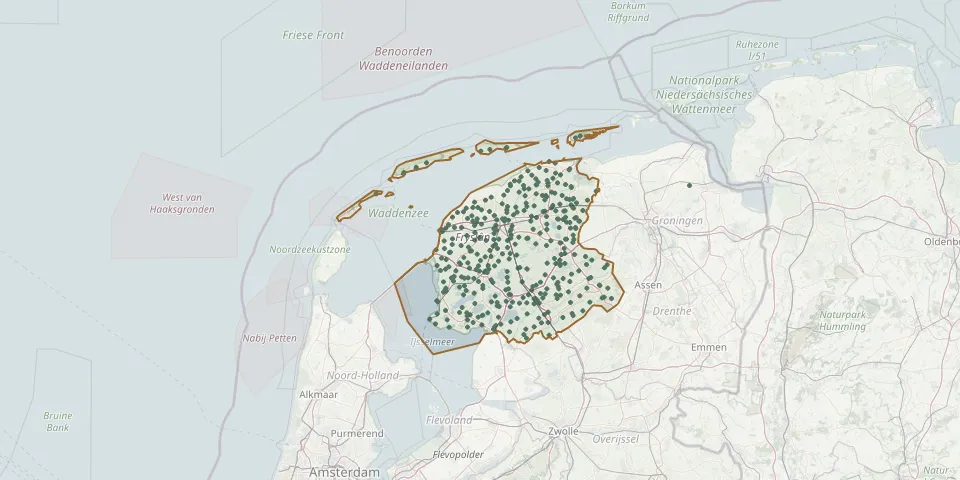 © OpenStreetMap
- Oldeouwer General CemeteryGPS coordinates: 52.92340° N, 5.80090° E
- Oldetrijne CemeteryGPS coordinates: 52.85665° N, 5.93186° E
- Oosterse Es CemeteryGPS coordinates: 52.95050° N, 6.35707° E
- Oosterwolde ChurchyardGPS coordinates: 52.99380° N, 6.29310° E
- Oosterzee-Buren CemeteryGPS coordinates: 52.86551° N, 5.74960° E
- Oostrum ChurchyardGPS coordinates: 53.33180° N, 6.06150° E
- Oppenhuizen CemeteryGPS coordinates: 53.01257° N, 5.69704° E
- Oranjewoud Jewish CemeteryGPS coordinates: 52.94489° N, 5.94931° E
- Oud Beets CemeteryGPS coordinates: 53.06658° N, 6.05075° E
- Oudega Anchor Church CemeteryGPS coordinates: 52.99240° N, 5.54950° E
- Oudega Dutch Reformed Church CemeteryGPS coordinates: 53.12550° N, 6.00050° E
- Oudehaske CemeteryGPS coordinates: 52.95451° N, 5.87188° E
- Oudehorne CemeteryGPS coordinates: 52.96170° N, 6.07650° E
- Oudeschoot CemeteryGPS coordinates: 52.93530° N, 5.95990° E
- Ouwsterhaule CemeteryGPS coordinates: 52.93878° N, 5.81407° E
- Parrega CemeteryGPS coordinates: 53.01864° N, 5.47791° E
- Petruskerk CemeteryGPS coordinates: 53.16680° N, 5.96610° E
- Petruskerk ChurchyardGPS coordinates: 53.30094° N, 5.84969° E
- Pieltsjerke ChurchyardGPS coordinates: 52.96270° N, 5.54530° E
- PrandingahofGPS coordinates: 52.99491° N, 6.29163° E
- Protestante kerkGPS coordinates: 52.83170° N, 5.87510° E
- Reahus CemeteryGPS coordinates: 53.07605° N, 5.63762° E
- Redbadtsjerke churchyardGPS coordinates: 53.14575° N, 5.71130° E
- Reduzum Municipal CemeteryGPS coordinates: 53.11980° N, 5.78660° E
- Rêsthôf BroeksterwâldGPS coordinates: 53.27588° N, 5.99073° E
- Ried St. Walburga Church CemeteryGPS coordinates: 53.22320° N, 5.59010° E
- Rijperkerk Dutch Reformed ChurchyardGPS coordinates: 53.22212° N, 5.91833° E
- Rinsumageest St. Alexander ChurchyardGPS coordinates: 53.29595° N, 5.94296° E
- Rode Dorp Jewish CemeteryGPS coordinates: 52.90142° N, 6.14085° E
- Rotstergaast CemeteryGPS coordinates: 52.90033° N, 5.89361° E