
Friesland
369 known cemeteries in Friesland, Netherlands.
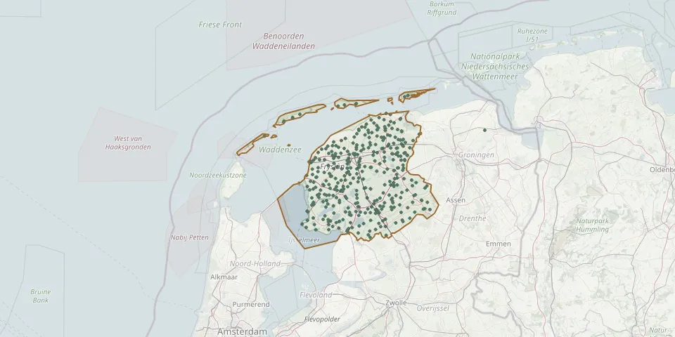 © OpenStreetMap
- De Westereen CemeteryGPS coordinates: 53.24978° N, 6.02737° E
- Doarpstsjerke SurhuisterveenGPS coordinates: 53.18140° N, 6.16230° E
- Doelhoftsjerke ChurchyardGPS coordinates: 53.04730° N, 5.89420° E
- Donkerbroek CemeteryGPS coordinates: 53.02020° N, 6.24390° E
- Donkerbroek Dutch Reformed ChurchyardGPS coordinates: 53.01700° N, 6.23310° E
- Dorhout Cemetery, LeeuwardenGPS coordinates: 53.21389° N, 5.75909° E
- Dorpskerk ChurchyardGPS coordinates: 53.32034° N, 6.13629° E
- Drachten North CemeteryGPS coordinates: 53.11594° N, 6.09730° E
- Drachten South CemeteryGPS coordinates: 53.09920° N, 6.10088° E
- Drachtstercompagnie General CemeteryGPS coordinates: 53.13540° N, 6.14540° E
- Drogeham Church CemeteryGPS coordinates: 53.20220° N, 6.10990° E
- Eanjum CemeteryGPS coordinates: 53.37480° N, 6.12451° E
- Eanjum CemeteryGPS coordinates: 53.37822° N, 6.12889° E
- Earnewâld Dutch Reformed ChurchyardGPS coordinates: 53.13159° N, 5.94251° E
- Easterwierrum Foundation CemeteryGPS coordinates: 53.11605° N, 5.73106° E
- Echten ChurchyardGPS coordinates: 52.87370° N, 5.80390° E
- Ee General CemeteryGPS coordinates: 53.32600° N, 6.10500° E
- Eesterga CemeteryGPS coordinates: 52.86107° N, 5.72165° E
- Egypte Nijerberkoop CemeteryGPS coordinates: 52.95912° N, 6.18266° E
- Eikenhof CemeteryGPS coordinates: 53.06175° N, 6.33410° E
- Elahuizen CemeteryGPS coordinates: 52.92133° N, 5.53698° E
- Elsloo CemeteryGPS coordinates: 52.93837° N, 6.23797° E
- Engelum Dutch Reformed ChurchyardGPS coordinates: 53.22480° N, 5.71430° E
- Erehof JelsumGPS coordinates: 53.23486° N, 5.78262° E
- Erehof MolkwerumGPS coordinates: 52.90020° N, 5.39908° E
- Erehof NoordwoldeGPS coordinates: 52.89476° N, 6.14715° E
- Erehof OpeindeGPS coordinates: 53.13445° N, 6.07558° E
- Erehof WitmarsumGPS coordinates: 53.10256° N, 5.46673° E
- Eysinga Cemetery, LeeuwardenGPS coordinates: 53.16003° N, 5.80568° E
- Feanwâlden Bûtefjild CemeteryGPS coordinates: 53.23789° N, 5.98158° E