
Friesland
369 known cemeteries in Friesland, Netherlands.
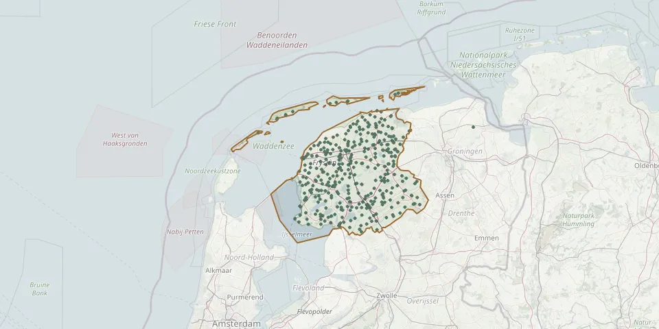 © OpenStreetMap
- Ferwerderadiel Ferwerd ChurchyardGPS coordinates: 53.33889° N, 5.82377° E
- Ferwoude CemeteryGPS coordinates: 53.00622° N, 5.43374° E
- Finkeburen General CemeteryGPS coordinates: 52.92620° N, 5.72878° E
- Fochteloo CemeteryGPS coordinates: 52.98512° N, 6.33779° E
- Follega Churchyard with Covered Bell FrameGPS coordinates: 52.88861° N, 5.73610° E
- Franeker General CemeteryGPS coordinates: 53.25140° N, 5.59497° E
- Friens Reformed ChurchyardGPS coordinates: 53.09900° N, 5.80010° E
- Friesland Natural Burial GroundGPS coordinates: 52.96267° N, 6.05368° E
- Gauw CemeteryGPS coordinates: 53.05863° N, 5.71400° E
- Gemeentelijke Behraafplaats SchiermonnikoogGPS coordinates: 53.47911° N, 6.16055° E
- Gerkeskleaster Reformed Church CemeteryGPS coordinates: 53.24110° N, 6.20050° E
- Gersloot CemeteryGPS coordinates: 53.00489° N, 5.96788° E
- Gertrudis Cemetery, BaardGPS coordinates: 53.14232° N, 5.66842° E
- Giekerk MartinuskerkGPS coordinates: 53.24117° N, 5.87853° E
- Ginnum Dutch Reformed Church CemeteryGPS coordinates: 53.32310° N, 5.87450° E
- Gorredijk General CemeteryGPS coordinates: 52.99070° N, 6.06490° E
- Gorredijk General Cemetery (construction)GPS coordinates: 52.99869° N, 6.05710° E
- Gorredijk Jewish CemeteryGPS coordinates: 52.98240° N, 6.06790° E
- Gorredijk Reformed CemeteryGPS coordinates: 53.00387° N, 6.06347° E
- Goutum CemeteryGPS coordinates: 53.17170° N, 5.80024° E
- Grou Municipal CemeteryGPS coordinates: 53.09396° N, 5.83591° E
- Hallum ChurchyardGPS coordinates: 53.30705° N, 5.78534° E
- Harich CemeteryGPS coordinates: 52.90289° N, 5.56357° E
- Harlingen General CemeteryGPS coordinates: 53.17801° N, 5.42459° E
- Harlingen Jewish CemeteryGPS coordinates: 53.17855° N, 5.42311° E
- Harlingen Roman Catholic CemeteryGPS coordinates: 53.17210° N, 5.42963° E
- Hartwerd Dutch Reformed CemeteryGPS coordinates: 53.06857° N, 5.56852° E
- Haskerdijken Chapel Church CemeteryGPS coordinates: 53.00580° N, 5.86740° E
- Heerenveen General CemeteryGPS coordinates: 52.96587° N, 5.99268° E
- Heerenveen Roman Catholic CemeteryGPS coordinates: 52.94957° N, 5.93200° E