
Friesland
369 known cemeteries in Friesland, Netherlands.
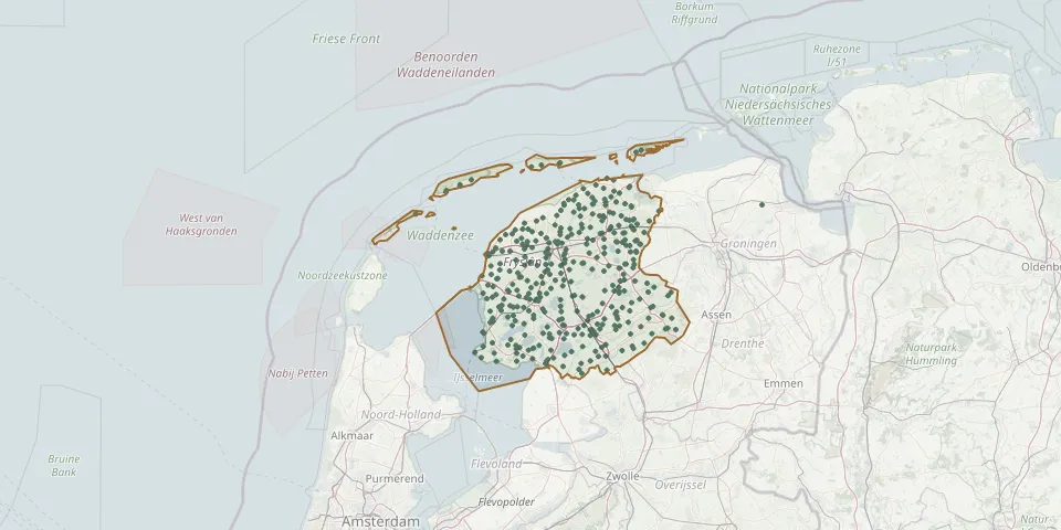 © OpenStreetMap
- Hemelum ChurchyardGPS coordinates: 52.88030° N, 5.45540° E
- Hemrik CemeteryGPS coordinates: 53.03086° N, 6.13822° E
- Hemrik White Church Protestant CemeteryGPS coordinates: 53.03170° N, 6.13770° E
- Herbaijum CemeteryGPS coordinates: 53.18510° N, 5.49520° E
- Hervormde Kerk, Jubbega-SchuregaGPS coordinates: 52.97270° N, 6.12060° E
- Hervormde kerk (Wartena)GPS coordinates: 53.14960° N, 5.89730° E
- Hijum Reformed Church ChurchyardGPS coordinates: 53.29200° N, 5.76630° E
- Hindeloopen General CemeteryGPS coordinates: 52.94026° N, 5.40374° E
- Hindeloopen Protestant ChurchyardGPS coordinates: 52.94291° N, 5.39849° E
- Hoftsjerke Cemetery, TietjerksteradeelGPS coordinates: 53.21758° N, 5.94452° E
- Hogebeintum ChurchyardGPS coordinates: 53.33690° N, 5.85010° E
- Hollum CemeteryGPS coordinates: 53.43570° N, 5.64050° E
- Holwerd Protestant ChurchyardGPS coordinates: 53.37105° N, 5.89722° E
- Hoorn Churchyard (Terschelling)GPS coordinates: 53.39733° N, 5.34177° E
- Huizum CemeteryGPS coordinates: 53.19075° N, 5.81185° E
- Idsegahuizum Dutch Reformed Church ChurchyardGPS coordinates: 53.04337° N, 5.41802° E
- IJlst General CemeteryGPS coordinates: 53.00673° N, 5.62595° E
- Ijpecolsga General CemeteryGPS coordinates: 52.93445° N, 5.60728° E
- Ingwierrum CemeteryGPS coordinates: 53.31716° N, 6.13799° E
- Irnsum Municipal CemeteryGPS coordinates: 53.08160° N, 5.79540° E
- It Readtsjerkje hôfGPS coordinates: 53.25628° N, 5.93327° E
- Jannum Dutch Reformed ChurchyardGPS coordinates: 53.31265° N, 5.90273° E
- Jeltingalaan CemeteryGPS coordinates: 53.25995° N, 6.13584° E
- Jezus Leeft CemeteryGPS coordinates: 53.14580° N, 6.15000° E
- Johannes de Doperkerk CemeteryGPS coordinates: 52.98370° N, 5.65050° E
- Johanneskerk OosthemGPS coordinates: 53.01670° N, 5.60070° E
- Johanneskerk - Protestantse Gemeente TzumGPS coordinates: 53.15898° N, 5.56291° E
- Joure Roman Catholic CemeteryGPS coordinates: 52.96377° N, 5.79474° E
- Jubbega CemeteryGPS coordinates: 53.00759° N, 6.12823° E
- Jubbega ChurchyardGPS coordinates: 52.95290° N, 5.98060° E