
North Brabant
544 known cemeteries in North Brabant, Netherlands.
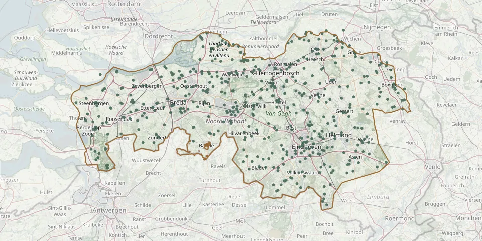 © OpenStreetMap
- Steenbergen Roman Catholic General CemeteryGPS coordinates: 51.58761° N, 4.32867° E
- Aalst General and Roman Catholic CemeteryGPS coordinates: 51.39788° N, 5.47080° E
- Abdij van Berne CemeteryGPS coordinates: 51.65559° N, 5.47183° E
- Achterstraat Roman Catholic Churchyard, Nieuw-VossemeerGPS coordinates: 51.58720° N, 4.21710° E
- Afferden CemeteryGPS coordinates: 51.63441° N, 6.01318° E
- Algememeen QuirinuskerkGPS coordinates: 51.52770° N, 4.26980° E
- Algemene Begraafplats Grave CityGPS coordinates: 51.75550° N, 5.74575° E
- Almkerk CemeteryGPS coordinates: 51.76234° N, 4.95440° E
- Almkerk Reformed CemeteryGPS coordinates: 51.77210° N, 4.96625° E
- Alphen CemeteryGPS coordinates: 51.82162° N, 5.47324° E
- Alphen CemeteryGPS coordinates: 51.82747° N, 5.47604° E
- Alphen Roman Catholic CemeteryGPS coordinates: 51.48358° N, 4.95329° E
- Andel Old Dutch Reformed CemeteryGPS coordinates: 51.78387° N, 5.05371° E
- Annunciation Parish Churchyard, GoirleGPS coordinates: 51.52649° N, 5.06259° E
- Antonius abt kerkGPS coordinates: 51.74690° N, 5.68360° E
- Antonius Abt KerkGPS coordinates: 51.77560° N, 5.67310° E
- Appeltern CemeteryGPS coordinates: 51.83268° N, 5.58604° E
- Assisië House Cemetery, BiezenmortelGPS coordinates: 51.61531° N, 5.18809° E
- Attelaken CemeteryGPS coordinates: 51.58552° N, 4.65752° E
- Baardwijk CemeteryGPS coordinates: 51.69210° N, 5.09190° E
- Baarle-Nassau Roman Catholic CemeteryGPS coordinates: 51.44414° N, 4.92902° E
- Bakel CemeteryGPS coordinates: 51.50459° N, 5.74210° E
- Balgoij CemeteryGPS coordinates: 51.78211° N, 5.71312° E
- Bavel ChurchyardGPS coordinates: 51.56584° N, 4.82901° E
- Beers Roman Catholic CemeteryGPS coordinates: 51.72615° N, 5.82689° E
- Beheading of St. John Cemetery, GemertGPS coordinates: 51.55509° N, 5.67869° E
- Beheading of St. John Church Cemetery, NulandGPS coordinates: 51.73117° N, 5.43315° E
- Beheading of St. John Roman Catholic Cemetery (new), Loon op ZandGPS coordinates: 51.62854° N, 5.07720° E
- Belgian War Cemetery 1940GPS coordinates: 51.69583° N, 4.44130° E
- Berg Cemetery, GeertruidenbergGPS coordinates: 51.70250° N, 4.85950° E