
North Brabant
544 known cemeteries in North Brabant, Netherlands.
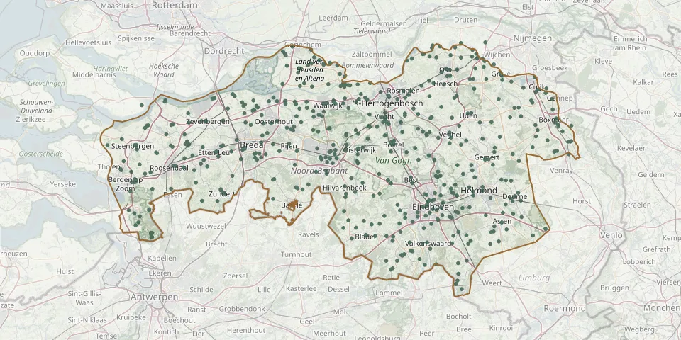 © OpenStreetMap
- Chaam Reformed CemeteryGPS coordinates: 51.50492° N, 4.85793° E
- Congregatie van de Heilige Geest CemeteryGPS coordinates: 51.55330° N, 5.67926° E
- Cromvoirt Sint-Lambertus Roman Catholic CemeteryGPS coordinates: 51.66153° N, 5.23098° E
- De Bucht Protestant Cemetery, BergeijkGPS coordinates: 51.32426° N, 5.36548° E
- De Heen CemeteryGPS coordinates: 51.60270° N, 4.27290° E
- De Hoberg Cemetery, SchutsboomGPS coordinates: 51.50313° N, 5.75918° E
- De Hoevens Natural Burial GroundGPS coordinates: 51.49254° N, 4.99477° E
- De Hoge Boght CemeteryGPS coordinates: 51.41199° N, 5.36918° E
- De Kapelakker Cemetery, LuyksgestelGPS coordinates: 51.28713° N, 5.31396° E
- De LichtenbergGPS coordinates: 51.55809° N, 4.81229° E
- Dellerhof General CemeteryGPS coordinates: 51.37762° N, 5.70325° E
- Demen Roman Catholic CemeteryGPS coordinates: 51.81629° N, 5.63065° E
- De Mortel ChurchyardGPS coordinates: 51.54060° N, 5.70910° E
- Den Dungen General CemeteryGPS coordinates: 51.65920° N, 5.36870° E
- Den Hout CemeteryGPS coordinates: 51.66003° N, 4.81357° E
- De Rips CemeteryGPS coordinates: 51.54989° N, 5.81018° E
- De RoosdonckenGPS coordinates: 51.48299° N, 5.54719° E
- Deurne Jewish CemeteryGPS coordinates: 51.46379° N, 5.79283° E
- Deurne Protestant CemeteryGPS coordinates: 51.46359° N, 5.79294° E
- De Willaert Cemetery, ZundertGPS coordinates: 51.47148° N, 4.66842° E
- Dinteloord Old CemeteryGPS coordinates: 51.63483° N, 4.37033° E
- Dinteloord Roman Catholic CemeteryGPS coordinates: 51.63541° N, 4.37448° E
- Don Bosco Roman Catholic Cemetery, OssGPS coordinates: 51.76897° N, 5.54239° E
- Dongen CemeteryGPS coordinates: 51.62679° N, 4.92685° E
- Dongen De Kremer CemeteryGPS coordinates: 51.63008° N, 4.91180° E
- Dongen Reformed Church CemeteryGPS coordinates: 51.62336° N, 4.93555° E
- Dongen Roman Catholic CemeteryGPS coordinates: 51.63239° N, 4.93898° E
- Driesprong Cemetery, BredaGPS coordinates: 51.59387° N, 4.81207° E
- Drimmelen Dutch Reformed CemeteryGPS coordinates: 51.67900° N, 4.79800° E
- Drunen Roman Catholic CemeteryGPS coordinates: 51.68858° N, 5.12957° E