
North Brabant
544 known cemeteries in North Brabant, Netherlands.
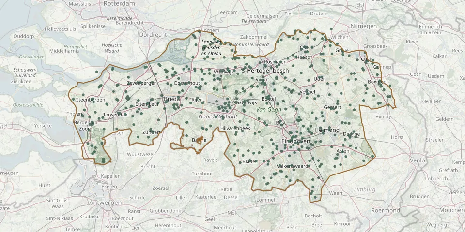 © OpenStreetMap
- Dussen CemeteryGPS coordinates: 51.73640° N, 4.97870° E
- Dussen Roman Catholic Church ChurchyardGPS coordinates: 51.73009° N, 4.96255° E
- Duynhaeghe CemeteryGPS coordinates: 51.67690° N, 5.14940° E
- Eckart CemeteryGPS coordinates: 51.46630° N, 5.50675° E
- Eerde CemeteryGPS coordinates: 51.60560° N, 5.49790° E
- Eersel Jewish CemeteryGPS coordinates: 51.36714° N, 5.32295° E
- Eikenboomgaard CemeteryGPS coordinates: 51.76350° N, 5.51000° E
- Eikenhof Cemetery, ValkenswaardGPS coordinates: 51.33727° N, 5.46674° E
- Eindhoven-Grote Beek Jewish CemeteryGPS coordinates: 51.46955° N, 5.44450° E
- Engelen CemeteryGPS coordinates: 51.71568° N, 5.27472° E
- Enschot Roman Catholic CemeteryGPS coordinates: 51.57639° N, 5.13895° E
- Erp CemeteryGPS coordinates: 51.59860° N, 5.60619° E
- Esbeek CemeteryGPS coordinates: 51.46254° N, 5.13795° E
- Escharen CemeteryGPS coordinates: 51.74447° N, 5.74567° E
- Etten-Leur Dutch Reformed CemeteryGPS coordinates: 51.56950° N, 4.63449° E
- Etten-Leur Municipal CemeteryGPS coordinates: 51.56030° N, 4.64620° E
- Etten-Leur Protestant Christian CemeteryGPS coordinates: 51.58720° N, 4.66450° E
- Etten-Leur Roman Catholic Cemetery (Stationsstraat)GPS coordinates: 51.57210° N, 4.63810° E
- Fijnaart ChurchyardGPS coordinates: 51.63640° N, 4.46440° E
- Fijnaart Protestant Congregation CemeteryGPS coordinates: 51.63790° N, 4.47010° E
- First Class of Eikenboomgaard Cemetery, OssGPS coordinates: 51.77133° N, 5.52737° E
- Franse PatersGPS coordinates: 51.76211° N, 5.73962° E
- Fraters, Huize Steenwijk CemeteryGPS coordinates: 51.63867° N, 5.30515° E
- Frechie Jewish cemeteryGPS coordinates: 51.37576° N, 4.38541° E
- Gageldonk CemeteryGPS coordinates: 51.49855° N, 4.31130° E
- Geertruidenberg CemeteryGPS coordinates: 51.69360° N, 4.84210° E
- Geffen Jewish CemeteryGPS coordinates: 51.73647° N, 5.47901° E
- Geldrop Protestant CemeteryGPS coordinates: 51.42769° N, 5.56562° E
- Gemonde CemeteryGPS coordinates: 51.61992° N, 5.35825° E
- Genderen Municipal CemeteryGPS coordinates: 51.73455° N, 5.07211° E