
North Brabant
544 known cemeteries in North Brabant, Netherlands.
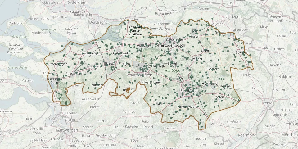 © OpenStreetMap
- Gerardus Majella CemeteryGPS coordinates: 51.77050° N, 5.53170° E
- Gershwin Cemetery - De Vlaspit Parish, TilburgGPS coordinates: 51.57594° N, 5.09959° E
- Giessen Nederlands Hervormd CemeteryGPS coordinates: 51.79247° N, 5.03701° E
- Gilze-en-rijen Gilze Roman Catholic CemeteryGPS coordinates: 51.54015° N, 4.94302° E
- Gilzerbaan General CemeteryGPS coordinates: 51.55445° N, 5.04636° E
- Godesakker Cemetery, Laag SpulGPS coordinates: 51.47030° N, 5.14086° E
- Goirle Dutch War Graves - Commonwealth War GravesGPS coordinates: 51.51901° N, 5.06601° E
- Goirle Sint-Jan Roman Catholic CemeteryGPS coordinates: 51.51912° N, 5.06522° E
- Graf van Jan FaasenGPS coordinates: 51.43017° N, 5.34904° E
- Grave Jewish CemeteryGPS coordinates: 51.75489° N, 5.74539° E
- Grave Roman Catholic ChurchyardGPS coordinates: 51.76030° N, 5.74022° E
- Grootschoterweg General CemeteryGPS coordinates: 51.25997° N, 5.57155° E
- Haarsteeg Roman Catholic CemeteryGPS coordinates: 51.71073° N, 5.19836° E
- Haghorst CemeteryGPS coordinates: 51.49664° N, 5.20467° E
- Halsteren Old CemeteryGPS coordinates: 51.52985° N, 4.26783° E
- Halsteren Protestant CemeteryGPS coordinates: 51.53060° N, 4.26710° E
- Handel New CemeteryGPS coordinates: 51.58140° N, 5.71700° E
- H. Antoniuskerk CemeteryGPS coordinates: 51.49644° N, 5.39664° E
- H. Antonius van Padua CemeteryGPS coordinates: 51.55270° N, 5.48250° E
- Haps CemeteryGPS coordinates: 51.69012° N, 5.86249° E
- Haps CemeteryGPS coordinates: 51.69539° N, 5.85792° E
- Hasselt Roman Catholic CemeteryGPS coordinates: 51.57129° N, 5.07567° E
- H. Cornelius ChurchyardGPS coordinates: 51.45320° N, 4.58330° E
- Heerle ChurchyardGPS coordinates: 51.51880° N, 4.36270° E
- Heesbeen Dutch Reformed CemeteryGPS coordinates: 51.72960° N, 5.11990° E
- Heesch Roman Catholic CemeteryGPS coordinates: 51.73314° N, 5.52001° E
- Heeze CemeteryGPS coordinates: 51.37826° N, 5.57600° E
- Heilige Antonius van Padua CemeteryGPS coordinates: 51.38427° N, 5.76253° E
- Heilige Caecilia Roman Catholic CemeteryGPS coordinates: 51.40331° N, 5.39835° E
- Heilige Clemenskerk ChurchyardGPS coordinates: 51.47317° N, 5.55119° E