
North Brabant
544 known cemeteries in North Brabant, Netherlands.
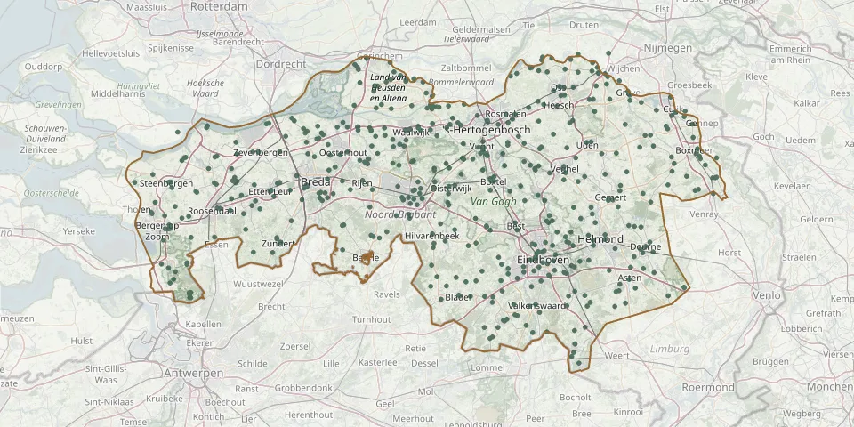 © OpenStreetMap
- Hoogen Heuvel CemeteryGPS coordinates: 51.75470° N, 5.54340° E
- Hoogerheide Roman Catholic CemeteryGPS coordinates: 51.42306° N, 4.32173° E
- Hooge Zwaluwe Drowned Persons' CemeteryGPS coordinates: 51.68212° N, 4.74376° E
- Hooge Zwaluwe Protestant CemeteryGPS coordinates: 51.69088° N, 4.73764° E
- H. Paulus CemeteryGPS coordinates: 51.61420° N, 5.45230° E
- Huijbergen Roman Catholic CemeteryGPS coordinates: 51.43270° N, 4.37810° E
- Huis ter Heide Natural Burial GroundGPS coordinates: 51.62038° N, 5.03266° E
- Hulsel St. Clement Parish CemeteryGPS coordinates: 51.38837° N, 5.17894° E
- Hulten CemeteryGPS coordinates: 51.57338° N, 4.95041° E
- H. Willibrorduskerk ChurchyardGPS coordinates: 51.61142° N, 5.29218° E
- In 1944 Verwoest Kerk.GPS coordinates: 51.79130° N, 5.37690° E
- Jacobshof CemeteryGPS coordinates: 51.45938° N, 5.77807° E
- Jan de Doper CemeteryGPS coordinates: 51.63278° N, 5.96269° E
- Jewish CemeteryGPS coordinates: 51.45079° N, 5.45776° E
- JodendekskeGPS coordinates: 51.59057° N, 4.51872° E
- Johannes de Doper ChurchyardGPS coordinates: 51.66040° N, 5.03410° E
- Johannes Evangelist ChurchyardGPS coordinates: 51.70030° N, 5.13650° E
- Keldonk CemeteryGPS coordinates: 51.58879° N, 5.58574° E
- Kerkhof Protestant CemeteryGPS coordinates: 51.36919° N, 5.55672° E
- Kerkhog GenovevakerkGPS coordinates: 51.51370° N, 5.50590° E
- Klein-Zundert Roman Catholic CemeteryGPS coordinates: 51.48140° N, 4.65530° E
- Klooster Sint Anna CemeteryGPS coordinates: 51.58956° N, 4.53291° E
- Klundert Old Jewish CemeteryGPS coordinates: 51.66454° N, 4.52878° E
- Koepelkerk ChurchyardGPS coordinates: 51.69217° N, 4.43830° E
- Koningskerkje ChurchyardGPS coordinates: 51.59625° N, 6.00915° E
- Korvel CemeteryGPS coordinates: 51.54711° N, 5.06759° E
- Kouwenberg CemeteryGPS coordinates: 51.72188° N, 5.88485° E
- Kruisland Protestant CemeteryGPS coordinates: 51.56872° N, 4.40813° E
- Kruisland Roman Catholic CemeteryGPS coordinates: 51.57020° N, 4.40550° E
- Laantje Churchyard, WerkendamGPS coordinates: 51.81255° N, 4.89673° E