
North Brabant
544 known cemeteries in North Brabant, Netherlands.
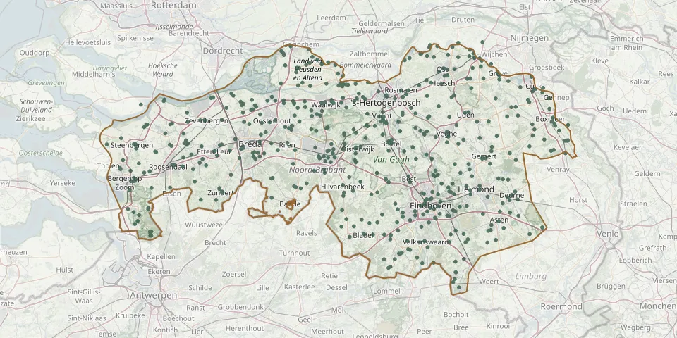 © OpenStreetMap
- Mierlo CemeteryGPS coordinates: 51.43798° N, 5.61893° E
- Mierlo War Cemetery, Noord-BrabantGPS coordinates: 51.43562° N, 5.59135° E
- Milheeze CemeteryGPS coordinates: 51.50187° N, 5.77936° E
- Missie huis KaatsheuvelGPS coordinates: 51.66040° N, 5.03520° E
- Missiezusters Franciscanessen van de H Antonius van Padua CemeteryGPS coordinates: 51.40067° N, 5.74353° E
- Moerdijk CemeteryGPS coordinates: 51.70001° N, 4.62338° E
- Moerdijk Roman Catholic CemeteryGPS coordinates: 51.70117° N, 4.63046° E
- Moerstraten CemeteryGPS coordinates: 51.54126° N, 4.34125° E
- Molenkreek CemeteryGPS coordinates: 51.62921° N, 4.36226° E
- Molensingel Roman Catholic Churchyard Complex, RavensteinGPS coordinates: 51.79639° N, 5.64889° E
- Munsel CemeteryGPS coordinates: 51.59891° N, 5.32683° E
- Nederlands Hervormd ChurchyardGPS coordinates: 51.73326° N, 5.13782° E
- Neerkant ChurchyardGPS coordinates: 51.36954° N, 5.86398° E
- Neerloon CemeteryGPS coordinates: 51.78976° N, 5.67735° E
- Netersel CemeteryGPS coordinates: 51.40517° N, 5.20966° E
- Nieuw-Borgvliet Roman Catholic Cemetery, Bergen op ZoomGPS coordinates: 51.47687° N, 4.30554° E
- Nieuw-Ginneken Roman Catholic CemeteryGPS coordinates: 51.55235° N, 4.79577° E
- Niftrik CemeteryGPS coordinates: 51.79552° N, 5.66923° E
- Nispen Roman Catholic CemeteryGPS coordinates: 51.48263° N, 4.46298° E
- Nistelrode Old CemeteryGPS coordinates: 51.70140° N, 5.55980° E
- Noordhoek ChurchyardGPS coordinates: 51.64200° N, 4.53310° E
- Noordtoren Cemetery, KrooswijkGPS coordinates: 51.64588° N, 4.58138° E
- Nuenen Old Tower CemeteryGPS coordinates: 51.47191° N, 5.55725° E
- Oijen Roman Catholic CemeteryGPS coordinates: 51.82490° N, 5.50400° E
- Oirschot Monastery CemeteryGPS coordinates: 51.50270° N, 5.30358° E
- Oirschot Roman Catholic CemeteryGPS coordinates: 51.50423° N, 5.30297° E
- Oisterwijk Jewish CemeteryGPS coordinates: 51.56597° N, 5.18577° E
- Oisterwijk Protestant ChurchyardGPS coordinates: 51.57969° N, 5.18746° E
- Olland ChurchyardGPS coordinates: 51.58060° N, 5.40760° E
- Ommel Parish ChurchyardGPS coordinates: 51.42458° N, 5.74750° E