
North Brabant
544 known cemeteries in North Brabant, Netherlands.
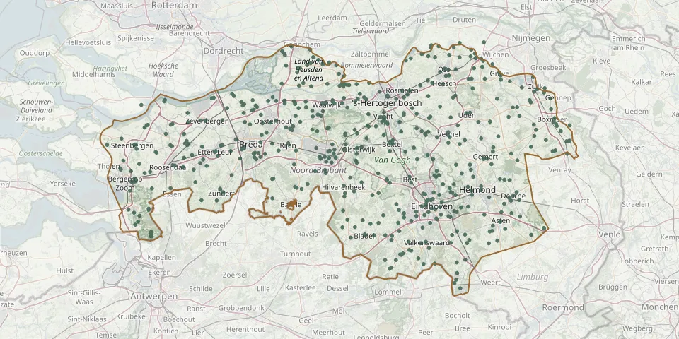 © OpenStreetMap
- Paul and St. John Cemetery, VughtGPS coordinates: 51.64310° N, 5.28397° E
- Peelrust Cemetery, GroeskuilenGPS coordinates: 51.57123° N, 5.71505° E
- Petrus Donders Norbertijnenparochie CemeteryGPS coordinates: 51.58860° N, 5.09130° E
- Poederoijen CemeteryGPS coordinates: 51.78598° N, 5.07841° E
- Prinsenbeek Roman Catholic CemeteryGPS coordinates: 51.60048° N, 4.71669° E
- Putte General Cemetery (new)GPS coordinates: 51.36580° N, 4.38660° E
- Putte General Cemetery (old)GPS coordinates: 51.36560° N, 4.38970° E
- Raamsdonk Roman Catholic CemeteryGPS coordinates: 51.68752° N, 4.90591° E
- Raamsdonksveer Our Lady of the Assumption ChurchyardGPS coordinates: 51.69328° N, 4.87372° E
- Rapelenburg St. Lambert ChurchyardGPS coordinates: 51.42514° N, 5.46466° E
- Ravenstein ChurchyardGPS coordinates: 51.79701° N, 5.64832° E
- Reusel CemeteryGPS coordinates: 51.36255° N, 5.16261° E
- Riel CemeteryGPS coordinates: 51.52378° N, 5.02407° E
- Rietbeemd Parish Cemetery, SchijndelGPS coordinates: 51.62017° N, 5.43832° E
- Riethoven St. Willibrord Church CemeteryGPS coordinates: 51.35299° N, 5.38678° E
- Rijsbergen ChurchyardGPS coordinates: 51.51400° N, 4.70034° E
- Rijswijk CemeteryGPS coordinates: 51.79916° N, 5.01693° E
- R.k. Antonius abtGPS coordinates: 51.74680° N, 5.63210° E
- R.K. Kerk Johannes de DoperGPS coordinates: 51.74050° N, 5.78040° E
- Roosendaal-en-Nispen Roman Catholic CemeteryGPS coordinates: 51.53816° N, 4.47188° E
- Roosendaal General CemeteryGPS coordinates: 51.53752° N, 4.48009° E
- Roosendaal Jewish CemeteryGPS coordinates: 51.53750° N, 4.48000° E
- Roostenhof CemeteryGPS coordinates: 51.40740° N, 5.49761° E
- Rosmalen ChurchyardGPS coordinates: 51.70880° N, 5.38300° E
- Rosmalen General CemeteryGPS coordinates: 51.71794° N, 5.39026° E
- Rucphen CemeteryGPS coordinates: 51.52780° N, 4.55290° E
- Rustoord Protestant Cemetery, BoxtelGPS coordinates: 51.59449° N, 5.31495° E
- Rustpunt in Beweging Cemetery, DinteloordGPS coordinates: 51.63484° N, 4.37027° E
- Saint CalixtusGPS coordinates: 51.43680° N, 5.50930° E
- Saint Monulphus Church Cemetery KnegselGPS coordinates: 51.39886° N, 5.34798° E