
North Brabant
544 known cemeteries in North Brabant, Netherlands.
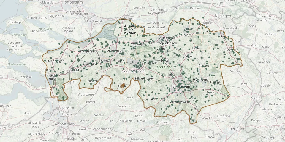 © OpenStreetMap
- Onderlinge Hulp CemeteryGPS coordinates: 51.77853° N, 4.91214° E
- Onsenoort General CemeteryGPS coordinates: 51.69840° N, 5.18994° E
- Onze Lieve Vrouwe Tenhemelopneming CemeteryGPS coordinates: 51.35539° N, 5.73171° E
- Onze lieve vrouwe van de Rozenkrans kerkGPS coordinates: 51.70470° N, 5.46360° E
- Onze-Lieve-Vrouw van Lourdes CemeteryGPS coordinates: 51.47213° N, 5.48491° E
- Ooltgensplaat CemeteryGPS coordinates: 51.68372° N, 4.34962° E
- Oostelbeers Roman Catholic Church CemeteryGPS coordinates: 51.47130° N, 5.27030° E
- Oosterhout Jewish CemeteryGPS coordinates: 51.63960° N, 4.82016° E
- Oosterhout Protestant CemeteryGPS coordinates: 51.64151° N, 4.85108° E
- Openbare CemeteryGPS coordinates: 51.78090° N, 5.05348° E
- Oploo CemeteryGPS coordinates: 51.60901° N, 5.87548° E
- Orthen CemeteryGPS coordinates: 51.70321° N, 5.30770° E
- Orthens ChurchyardGPS coordinates: 51.70665° N, 5.30523° E
- Ossendrecht Eikelhof CemeteryGPS coordinates: 51.39428° N, 4.32631° E
- Oss Jewish CemeteryGPS coordinates: 51.75387° N, 5.53232° E
- Oud-Drimmelen Old CemeteryGPS coordinates: 51.69527° N, 4.78159° E
- Oude Landen Cemetery, NuenenGPS coordinates: 51.46604° N, 5.56972° E
- Oudenbosch Roman Catholic CemeteryGPS coordinates: 51.58912° N, 4.53109° E
- Oud Gastel Dutch Reformed CemeteryGPS coordinates: 51.58400° N, 4.46845° E
- Oud Ginneken ChurchyardGPS coordinates: 51.56662° N, 4.78532° E
- Our Lady in the Woods Cemetery, WouwGPS coordinates: 51.52270° N, 4.38354° E
- Our Lady of the Immaculate Conception Churchyard, HankGPS coordinates: 51.73500° N, 4.89480° E
- Ouwerkerk Protestant CemeteryGPS coordinates: 51.64836° N, 5.29221° E
- Overakker Cemetery, BredaGPS coordinates: 51.56764° N, 4.80442° E
- Overloon War CemeteryGPS coordinates: 51.57415° N, 5.95766° E
- Parochie Heilige KruisvindingGPS coordinates: 51.64333° N, 5.70364° E
- Parochie H. Gummarus CemeteryGPS coordinates: 51.66470° N, 4.74680° E
- Parochie H. Willibrordus Roman Catholic CemeteryGPS coordinates: 51.39630° N, 5.23940° E
- Parochie Sint Joris CemeteryGPS coordinates: 51.41848° N, 5.51356° E
- Paters van SparrendaalGPS coordinates: 51.63244° N, 5.26102° E