
Lower Silesian Voivodeship
1,407 known cemeteries in Lower Silesian Voivodeship, Poland.
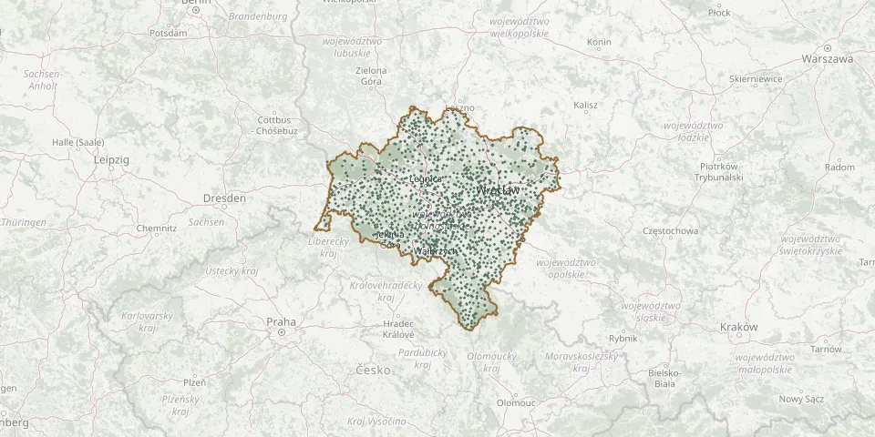 © OpenStreetMap
- Borów Parish CemeteryGPS coordinates: 50.88405° N, 16.99468° E
- Mościsko CemeteryGPS coordinates: 50.78318° N, 16.58684° E
- Sieroszowice Municipal CemeteryGPS coordinates: 51.51868° N, 15.93638° E
- Sobótka Municipal CemeteryGPS coordinates: 50.89751° N, 16.74186° E
- Holy Family Parish CemeteryGPS coordinates: 51.10921° N, 17.11185° E
- Janowice Wielkie Municipal CemeteryGPS coordinates: 50.88477° N, 15.92511° E
- Kotla Municipal CemeteryGPS coordinates: 51.74611° N, 16.03582° E
- Lądek Zdrój Parish CemeteryGPS coordinates: 50.34250° N, 16.87133° E
- Oleśnica Municipal CemeteryGPS coordinates: 51.21444° N, 17.39075° E
- Piersna CemeteryGPS coordinates: 51.62646° N, 16.27520° E
- Sobin Parish CemeteryGPS coordinates: 51.47771° N, 16.02988° E
- Wojciechów CemeteryGPS coordinates: 51.23022° N, 15.89112° E
- Bielany Wrocławskie Municipal CemeteryGPS coordinates: 51.03241° N, 16.96022° E
- Bolesławiec Municipal CemeteryGPS coordinates: 51.25750° N, 15.55250° E
- Brunów Parish CemeteryGPS coordinates: 51.39647° N, 16.07322° E
- Glinka Parish Cemetery (St. Martin)GPS coordinates: 51.71212° N, 16.52657° E
- Świerzawa Municipal CemeteryGPS coordinates: 51.02065° N, 15.88913° E
- Wierzchowice Parish CemeteryGPS coordinates: 51.48232° N, 17.33015° E
- Buczyna Orthodox Parish CemeteryGPS coordinates: 51.54094° N, 15.90980° E
- Góra CemeteryGPS coordinates: 51.61988° N, 16.50501° E
- Ręków CemeteryGPS coordinates: 50.92641° N, 16.83250° E
- St. Martin Parish Cemetery, ŚwięteGPS coordinates: 51.18195° N, 16.64866° E
- Swojczyce Parish Cemetery, Wrocław (St. Hyacinth)GPS coordinates: 51.11138° N, 17.12627° E
- Zimna Brzeźnica CemeteryGPS coordinates: 51.65502° N, 15.82219° E
- Bystrzyca Oławska Municipal CemeteryGPS coordinates: 50.95772° N, 17.41055° E
- Krępa CemeteryGPS coordinates: 51.54168° N, 15.85646° E
- Modlikowice Parish CemeteryGPS coordinates: 51.22692° N, 15.84453° E
- Radosław CemeteryGPS coordinates: 51.75644° N, 16.48734° E
- Sobótka West CemeteryGPS coordinates: 50.89320° N, 16.70450° E
- Świdnica Evangelical CemeteryGPS coordinates: 50.84647° N, 16.49135° E