
Lublin Voivodeship
1,041 known cemeteries in Lublin Voivodeship, Poland.
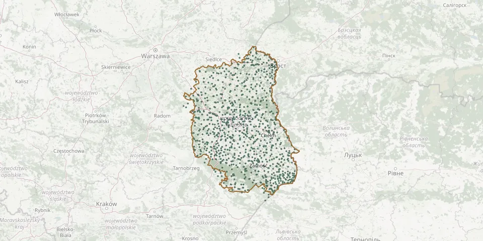 © OpenStreetMap
- Goraj Jewish CemeteryGPS coordinates: 50.71950° N, 22.66337° E
- Goraj Parish CemeteryGPS coordinates: 50.71948° N, 22.66042° E
- Góra Puławska CemeteryGPS coordinates: 51.41100° N, 21.92299° E
- Góra Puławska World War I CemeteryGPS coordinates: 51.41446° N, 21.92847° E
- Górecko KościelneGPS coordinates: 50.50100° N, 22.97343° E
- Górka Lubartowska CemeteryGPS coordinates: 51.51452° N, 22.64814° E
- Gorzków Jewish CemeteryGPS coordinates: 50.94155° N, 23.01180° E
- Gorzków Parish CemeteryGPS coordinates: 50.94936° N, 23.01301° E
- Gościeradów Plebański Parish CemeteryGPS coordinates: 50.85822° N, 21.99929° E
- Gościeradów War CemeteryGPS coordinates: 50.87734° N, 21.98829° E
- Gózd Lipiński Parish CemeteryGPS coordinates: 50.44917° N, 22.55142° E
- Gozdów Parish CemeteryGPS coordinates: 50.78891° N, 23.79314° E
- Grabówka Parish CemeteryGPS coordinates: 50.95385° N, 21.95438° E
- Grabówka Parish CemeteryGPS coordinates: 50.91903° N, 21.96435° E
- Grabówki Parish CemeteryGPS coordinates: 51.29267° N, 22.06249° E
- Gręzówka Roman Catholic Cemetery (now War Cemetery)GPS coordinates: 51.99567° N, 22.28343° E
- Groby matki i trójki dzieci spalonych przez niemcówGPS coordinates: 50.53617° N, 22.94916° E
- Gródek Parish CemeteryGPS coordinates: 50.47822° N, 23.61832° E
- Gródek Parish Cemetery with Military SectionGPS coordinates: 51.46305° N, 21.67393° E
- Gródki Polish Catholic CemeteryGPS coordinates: 50.78023° N, 22.69808° E
- Hajowniki World War I CemeteryGPS coordinates: 50.83872° N, 23.43272° E
- Hanna Roman Catholic CemeteryGPS coordinates: 51.72088° N, 23.50636° E
- Hańsk Pierwszy CemeteryGPS coordinates: 51.40068° N, 23.41154° E
- Hola Old Believers' CemeteryGPS coordinates: 51.55245° N, 23.18827° E
- Holeszów Roman Catholic CemeteryGPS coordinates: 51.68979° N, 23.38692° E
- Hołowno Orthodox CemeteryGPS coordinates: 51.64895° N, 23.20528° E
- Honiatycze Parish CemeteryGPS coordinates: 50.69180° N, 23.66926° E
- Hopkie Orthodox CemeteryGPS coordinates: 50.51340° N, 23.67275° E
- Horbów Parish CemeteryGPS coordinates: 52.04948° N, 23.33280° E
- Horodło New Jewish CemeteryGPS coordinates: 50.88607° N, 24.04614° E