
Lublin Voivodeship
1,041 known cemeteries in Lublin Voivodeship, Poland.
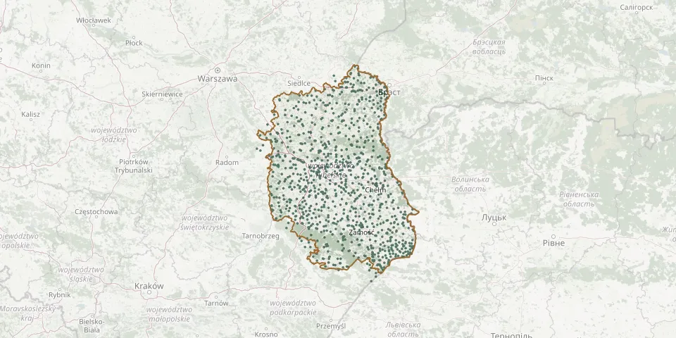 © OpenStreetMap
- Puławy Municipal CemeteryGPS coordinates: 51.42472° N, 21.95176° E
- Puławy Municipal CemeteryGPS coordinates: 51.45669° N, 21.95024° E
- Puławy Old Jewish CemeteryGPS coordinates: 51.39995° N, 21.97452° E
- Puszno Skokowskie Parish CemeteryGPS coordinates: 51.09529° N, 22.03172° E
- Rachanie Parish CemeteryGPS coordinates: 50.54115° N, 23.54887° E
- Radawczyk Boboszów War CemeteryGPS coordinates: 51.17273° N, 22.40223° E
- Radawiec Duży Parish CemeteryGPS coordinates: 51.20437° N, 22.38942° E
- Radcze Roman Catholic CemeteryGPS coordinates: 51.75362° N, 22.97355° E
- Radecznica Parish CemeteryGPS coordinates: 50.75057° N, 22.82639° E
- Radków Denominational Cemetery (now Roman Catholic)GPS coordinates: 50.49745° N, 23.88238° E
- Radruż Old CemeteryGPS coordinates: 50.17631° N, 23.40120° E
- Radzyń Podlaski Municipal CemeteryGPS coordinates: 51.76843° N, 22.62254° E
- Radzyń Podlaski New Jewish CemeteryGPS coordinates: 51.76914° N, 22.62156° E
- Radzyń Podlaski Parish CemeteryGPS coordinates: 51.77948° N, 22.63927° E
- Rakołupy Parish CemeteryGPS coordinates: 50.97260° N, 23.43968° E
- Ratoszyn Pierwszy Parish CemeteryGPS coordinates: 51.08388° N, 22.16473° E
- Ratyczów Denominational Cemetery (now Orthodox)GPS coordinates: 50.49246° N, 23.72088° E
- Rejowiec CemeteryGPS coordinates: 51.09639° N, 23.28169° E
- Rejowiec Fabryczny Municipal CemeteryGPS coordinates: 51.12853° N, 23.24946° E
- Rejowiec Jewish CemeteryGPS coordinates: 51.09748° N, 23.28029° E
- Rejowiec Municipal CemeteryGPS coordinates: 51.10197° N, 23.27635° E
- Rokitno Roman Catholic Cemetery (now Denominational)GPS coordinates: 52.11565° N, 23.29171° E
- Rokitno War CemeteryGPS coordinates: 52.11602° N, 23.24477° E
- Rossosz New Roman Catholic CemeteryGPS coordinates: 51.84817° N, 23.14086° E
- Rossosz Uniate Catholic CemeteryGPS coordinates: 51.86295° N, 23.14045° E
- Rotunda War Cemetery, ZamośćGPS coordinates: 50.71153° N, 23.24763° E
- Różaniec Drugi Parish CemeteryGPS coordinates: 50.33960° N, 22.80977° E
- Różaniec Pierwszy Denominational Cemetery (now Orthodox)GPS coordinates: 50.33637° N, 22.84002° E
- Różanka Roman Catholic CemeteryGPS coordinates: 51.62268° N, 23.53286° E
- Różanka Uniate CemeteryGPS coordinates: 51.61776° N, 23.53811° E