
Lublin Voivodeship
1,041 known cemeteries in Lublin Voivodeship, Poland.
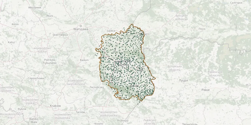 © OpenStreetMap
- Rozkopaczew Polish Catholic CemeteryGPS coordinates: 51.40348° N, 22.85592° E
- Rozkopaczew Roman Catholic CemeteryGPS coordinates: 51.42349° N, 22.85676° E
- Rozwadówka-Folwark CemeteryGPS coordinates: 51.75506° N, 23.28191° E
- Ruda-Huta Parish CemeteryGPS coordinates: 51.23662° N, 23.60536° E
- Ruda Orthodox CemeteryGPS coordinates: 51.25806° N, 23.59954° E
- Rudnik Parish CemeteryGPS coordinates: 50.88540° N, 22.97565° E
- Rudnik Szlachecki Parish CemeteryGPS coordinates: 50.96025° N, 22.32845° E
- Rudno ChurchyardGPS coordinates: 51.75322° N, 22.95036° E
- Rudno Pierwsze Historic Epidemic CemeteryGPS coordinates: 51.74501° N, 22.94455° E
- Rybczewice War CemeteryGPS coordinates: 51.04136° N, 22.85229° E
- Rybitwy Parish CemeteryGPS coordinates: 51.02731° N, 21.84829° E
- Ryki Jewish CemeteryGPS coordinates: 51.62720° N, 21.94222° E
- Rzeczyca Denominational Cemetery (now Greek Catholic)GPS coordinates: 50.45002° N, 23.74255° E
- Rzeczyca Księża Parish CemeteryGPS coordinates: 50.86983° N, 22.22444° E
- Rzeczyca Ziemiańska Parish CemeteryGPS coordinates: 50.84872° N, 22.18260° E
- Rzeplin Old Orthodox CemeteryGPS coordinates: 50.46635° N, 23.85624° E
- Rzeplin Parish CemeteryGPS coordinates: 50.47288° N, 23.84547° E
- Rzymskokatolicko-prawosławny CemeteryGPS coordinates: 50.80214° N, 23.90539° E
- Sahryń Orthodox CemeteryGPS coordinates: 50.67833° N, 23.79697° E
- Sahryń Parish CemeteryGPS coordinates: 50.66894° N, 23.79199° E
- Sawin Jewish CemeteryGPS coordinates: 51.28200° N, 23.42000° E
- Sawin Parish CemeteryGPS coordinates: 51.27389° N, 23.44926° E
- Serniki Parish CemeteryGPS coordinates: 51.42911° N, 22.66632° E
- Serokomla Evangelical CemeteryGPS coordinates: 51.71762° N, 22.32378° E
- Serokomla Parish CemeteryGPS coordinates: 51.70245° N, 22.34063° E
- Siedliska Drugie Parish CemeteryGPS coordinates: 51.05433° N, 22.93601° E
- Siedliska Old Orthodox CemeteryGPS coordinates: 50.73321° N, 23.16657° E
- Siedliska Parish CemeteryGPS coordinates: 50.26238° N, 23.55548° E
- Siedliszcze Jewish CemeteryGPS coordinates: 51.19527° N, 23.15842° E
- Siedliszcze Orthodox CemeteryGPS coordinates: 51.28984° N, 23.63967° E