
Lublin Voivodeship
1,041 known cemeteries in Lublin Voivodeship, Poland.
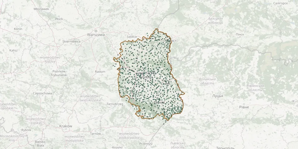 © OpenStreetMap
- Starościn Parish CemeteryGPS coordinates: 51.40002° N, 22.40636° E
- Stary Bazanów Parish CemeteryGPS coordinates: 51.63122° N, 22.01219° E
- Stary Brus CemeteryGPS coordinates: 51.49511° N, 23.28853° E
- Stary Uścimów Orthodox Cemetery (now Roman Catholic)GPS coordinates: 51.46811° N, 22.94096° E
- Stary Zamość Parish CemeteryGPS coordinates: 50.81965° N, 23.15928° E
- Stary Zamość War Cemetery (World War I)GPS coordinates: 50.85920° N, 23.15850° E
- Stawce CemeteryGPS coordinates: 50.88673° N, 22.52109° E
- Staw CemeteryGPS coordinates: 51.19061° N, 23.40374° E
- Staw Noakowski CemeteryGPS coordinates: 50.82252° N, 23.03372° E
- Staw Noakowski Military CemeteryGPS coordinates: 50.80815° N, 23.02911° E
- Staw Parish CemeteryGPS coordinates: 51.18348° N, 23.40231° E
- St. Basil Parish Cemetery, ŚwierszczówGPS coordinates: 51.33568° N, 23.18727° E
- Stefankowice Orthodox CemeteryGPS coordinates: 50.90326° N, 23.82135° E
- Stefanów Historic Evangelical CemeteryGPS coordinates: 51.31047° N, 23.04815° E
- Steniatyn Denominational Cemetery (now Orthodox)GPS coordinates: 50.51478° N, 23.78754° E
- Steniatyn New Orthodox CemeteryGPS coordinates: 50.52000° N, 23.78663° E
- Stężyca Nadwieprzańska Parish CemeteryGPS coordinates: 51.04737° N, 23.14058° E
- St. John the Theologian Parish Cemetery, BezekGPS coordinates: 51.20432° N, 23.27099° E
- Stoczek Łukowski January Uprising Insurgents' CemeteryGPS coordinates: 51.95729° N, 21.96957° E
- Stróża-Kolonia Parish CemeteryGPS coordinates: 50.89781° N, 22.28549° E
- Strzyżów CemeteryGPS coordinates: 50.88607° N, 24.04614° E
- Strzyżów Old Orthodox CemeteryGPS coordinates: 50.84762° N, 24.02611° E
- Studzianka Muslim CemeteryGPS coordinates: 51.93701° N, 23.21264° E
- Studzianki Parish CemeteryGPS coordinates: 50.90033° N, 22.43765° E
- Suchowola Old CemeteryGPS coordinates: 50.58430° N, 23.25412° E
- Suchowola Parish CemeteryGPS coordinates: 51.70244° N, 22.73638° E
- Suchowola Parish CemeteryGPS coordinates: 50.58412° N, 23.24916° E
- Sulimów Parish CemeteryGPS coordinates: 50.51969° N, 24.02710° E
- Sulimów Parish CemeteryGPS coordinates: 50.52191° N, 24.05360° E
- Sułowiec War Cemetery (1915)GPS coordinates: 50.76854° N, 22.88203° E