
Lublin Voivodeship
1,041 known cemeteries in Lublin Voivodeship, Poland.
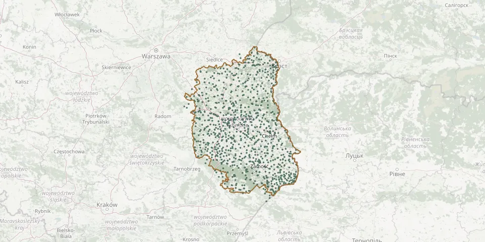 © OpenStreetMap
- Sulów Parish CemeteryGPS coordinates: 50.91045° N, 22.35455° E
- Surhów CemeteryGPS coordinates: 50.94031° N, 23.28225° E
- Świdnik Duży Pierwszy Parish CemeteryGPS coordinates: 51.25865° N, 22.69654° E
- Świdniki Parish CemeteryGPS coordinates: 50.79692° N, 23.51335° E
- Świdnik Municipal Cemetery, ŚwidnikGPS coordinates: 51.20021° N, 22.69191° E
- Świeciechów Poduchowny Parish CemeteryGPS coordinates: 50.92567° N, 21.84940° E
- Świerszczów Orthodox Cemetery (1875)GPS coordinates: 51.33037° N, 23.18928° E
- Świerże Former Orthodox CemeteryGPS coordinates: 51.21720° N, 23.73609° E
- Świerże New Parish CemeteryGPS coordinates: 51.23274° N, 23.72725° E
- Świerże Old Parish CemeteryGPS coordinates: 51.20920° N, 23.73568° E
- Swory Parish CemeteryGPS coordinates: 52.07538° N, 22.92279° E
- Sycyna Former Uniate Cemetery (historic)GPS coordinates: 52.02829° N, 22.94487° E
- Syczyn Parish CemeteryGPS coordinates: 51.28891° N, 23.25570° E
- Szaniawy-Matysy Parish CemeteryGPS coordinates: 51.95168° N, 22.50991° E
- Szarowola Parish CemeteryGPS coordinates: 50.49156° N, 23.35847° E
- Szastarka Parish CemeteryGPS coordinates: 50.85956° N, 22.33524° E
- Szczebrzeszyn Jewish CemeteryGPS coordinates: 50.69339° N, 22.97328° E
- Szczecyn Parish CemeteryGPS coordinates: 50.82220° N, 21.98416° E
- Szczepiatyn Roman Catholic CemeteryGPS coordinates: 50.42680° N, 23.82061° E
- Szczety War Cemetery, BełżecGPS coordinates: 50.37388° N, 23.44190° E
- Szóstka Roman Catholic CemeteryGPS coordinates: 51.86886° N, 22.78890° E
- Targowica Cemetery, ChełmGPS coordinates: 51.12958° N, 23.46909° E
- Targowisko Parish CemeteryGPS coordinates: 50.87462° N, 22.62621° E
- Tarło Historic CemeteryGPS coordinates: 51.51697° N, 22.69085° E
- Tarło-Kolonia CemeteryGPS coordinates: 51.50059° N, 22.70295° E
- Tarnawatka CemeteryGPS coordinates: 50.50486° N, 23.43199° E
- Tarnawatka Former Orthodox CemeteryGPS coordinates: 50.52986° N, 23.39935° E
- Tarnawatka Parish CemeteryGPS coordinates: 50.52972° N, 23.39855° E
- Tarnawka Druga War Cemetery (World War I)GPS coordinates: 50.90936° N, 22.62769° E
- Tarnogóra-Kolonia World War I CemeteryGPS coordinates: 50.91280° N, 23.09682° E