
Opole Voivodeship
690 known cemeteries in Opole Voivodeship, Poland.
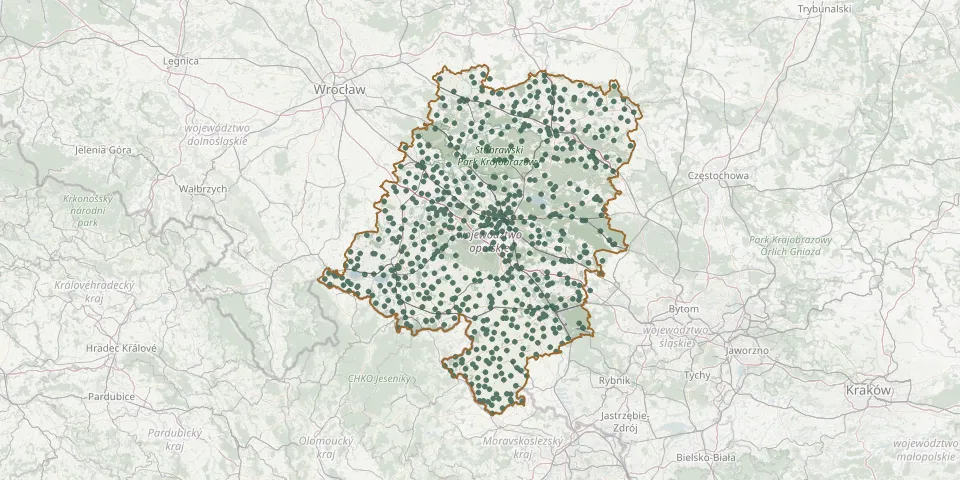 © OpenStreetMap
- Opole Roman Catholic CemeteryGPS coordinates: 50.65450° N, 17.84409° E
- Opole Sławice St. John of Nepomuk Parish CemeteryGPS coordinates: 50.70150° N, 17.86180° E
- Opole-Zakrzów Municipal CemeteryGPS coordinates: 50.68392° N, 17.91572° E
- Osiedle XXV-lecia Municipal CemeteryGPS coordinates: 50.66108° N, 17.88603° E
- Osiny Roman Catholic CemeteryGPS coordinates: 50.64093° N, 17.84380° E
- Ostrożnica Holy Spirit Parish CemeteryGPS coordinates: 50.24292° N, 18.08700° E
- Otmuchów CemeteryGPS coordinates: 50.46784° N, 17.21865° E
- Otmuchów CemeteryGPS coordinates: 50.46652° N, 17.16972° E
- Our Lady of Częstochowa Parish Cemetery, SarnówGPS coordinates: 51.06551° N, 18.20154° E
- Ozimek Municipal CemeteryGPS coordinates: 50.67000° N, 18.18740° E
- Paczków Jewish Cemetery RuinsGPS coordinates: 50.47029° N, 16.99763° E
- Paczków Municipal CemeteryGPS coordinates: 50.46257° N, 17.01680° E
- Pakosławice Roman Catholic CemeteryGPS coordinates: 50.54829° N, 17.37076° E
- Paruszowice Evangelical CemeteryGPS coordinates: 51.07921° N, 18.24283° E
- Pępice Parish CemeteryGPS coordinates: 50.81857° N, 17.41237° E
- Pielgrzymów Roman Catholic ChurchyardGPS coordinates: 50.17757° N, 17.66738° E
- Pietna Burial GroundGPS coordinates: 50.44757° N, 17.95355° E
- Pilszcz Roman Catholic CemeteryGPS coordinates: 49.99724° N, 17.92566° E
- Piorunkowice Burial GroundGPS coordinates: 50.40429° N, 17.51112° E
- Piotrówka CemeteryGPS coordinates: 50.56638° N, 18.37852° E
- Pludry Roman Catholic CemeteryGPS coordinates: 50.67379° N, 18.47027° E
- Płużnica Wielka New Parish CemeteryGPS coordinates: 50.47252° N, 18.46869° E
- Pogorzela Roman Catholic CemeteryGPS coordinates: 50.79089° N, 17.49133° E
- Pokój Evangelical CemeteryGPS coordinates: 50.90384° N, 17.84001° E
- Pokój Jewish CemeteryGPS coordinates: 50.91077° N, 17.84123° E
- Pokój Parish CemeteryGPS coordinates: 50.89725° N, 17.84621° E
- Pokrzywnica Roman Catholic CemeteryGPS coordinates: 50.33746° N, 18.06042° E
- Polanowice Evangelical CemeteryGPS coordinates: 51.10575° N, 18.17773° E
- Polska Cerekiew CemeteryGPS coordinates: 50.22708° N, 18.12096° E
- Polska Nowa Wieś Roman Catholic CemeteryGPS coordinates: 50.63782° N, 17.80696° E