
Opole Voivodeship
690 known cemeteries in Opole Voivodeship, Poland.
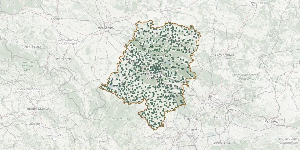 © OpenStreetMap
- Polski Świętów CemeteryGPS coordinates: 50.38889° N, 17.35528° E
- Popielów Roman Catholic Parish CemeteryGPS coordinates: 50.82314° N, 17.74500° E
- Posucice Roman Catholic ChurchyardGPS coordinates: 50.07350° N, 17.82832° E
- Poznowice Roman Catholic CemeteryGPS coordinates: 50.51934° N, 18.15031° E
- Prądy Roman Catholic CemeteryGPS coordinates: 50.65427° N, 17.71373° E
- Prędocin CemeteryGPS coordinates: 50.84167° N, 17.56573° E
- Proślice CemeteryGPS coordinates: 51.09956° N, 18.12261° E
- Prószków Old Evangelical CemeteryGPS coordinates: 50.57723° N, 17.87481° E
- Prószków Roman Catholic CemeteryGPS coordinates: 50.57902° N, 17.87619° E
- Prudnik Municipal CemeteryGPS coordinates: 50.31912° N, 17.56996° E
- Prusinowice CemeteryGPS coordinates: 50.53795° N, 17.40243° E
- Przechód Parish CemeteryGPS coordinates: 50.53324° N, 17.66988° E
- Przecza Evangelical Cemetery (now Roman Catholic)GPS coordinates: 50.73030° N, 17.66015° E
- Przedmość Parish CemeteryGPS coordinates: 51.09250° N, 18.43886° E
- Przełęk CemeteryGPS coordinates: 50.41210° N, 17.33060° E
- Przewóz Parish CemeteryGPS coordinates: 50.22503° N, 18.25401° E
- Przydroże Małe Roman Catholic CemeteryGPS coordinates: 50.44261° N, 17.57394° E
- Przylesie Evangelical Cemetery (now Roman Catholic)GPS coordinates: 50.79024° N, 17.39408° E
- Przysiecz Roman Catholic ChurchyardGPS coordinates: 50.55750° N, 17.86007° E
- Przywory Roman Catholic CemeteryGPS coordinates: 50.56992° N, 17.98965° E
- Racławice Śląskie Roman Catholic CemeteryGPS coordinates: 50.31334° N, 17.77446° E
- Racławiczki Roman Catholic CemeteryGPS coordinates: 50.46924° N, 17.79556° E
- Radawie Roman Catholic CemeteryGPS coordinates: 50.78348° N, 18.29565° E
- Radłów Roman Catholic CemeteryGPS coordinates: 50.93355° N, 18.53791° E
- Radomierowice Parish ChurchyardGPS coordinates: 50.93119° N, 18.03257° E
- Radoszowice Former Cemetery GroundsGPS coordinates: 50.69439° N, 17.51878° E
- Radoszowy St. Hedwig Parish CemeteryGPS coordinates: 50.20765° N, 18.04023° E
- Radynia Roman Catholic CemeteryGPS coordinates: 50.15016° N, 17.66695° E
- Radziejów Roman Catholic CemeteryGPS coordinates: 50.32906° N, 18.08947° E
- Raków Parish CemeteryGPS coordinates: 50.13024° N, 18.02618° E