
Subcarpathian Voivodeship
1,346 known cemeteries in Subcarpathian Voivodeship, Poland.
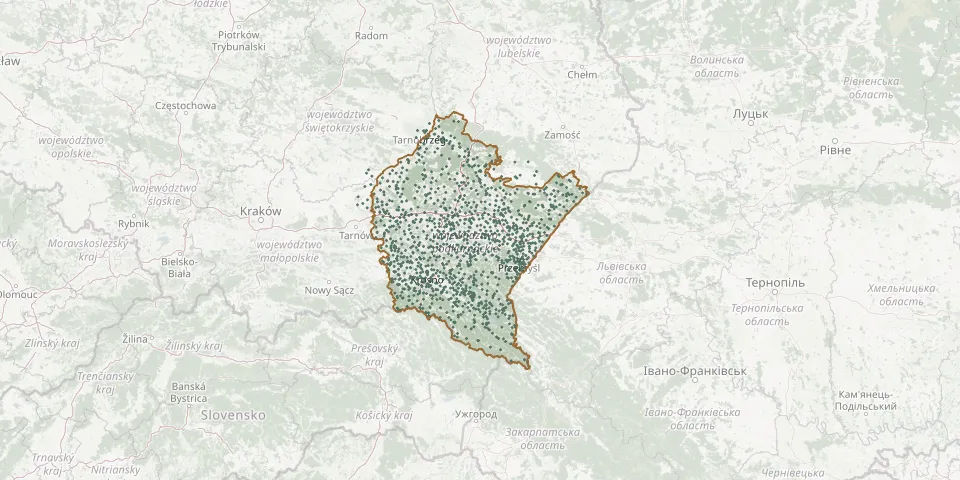 © OpenStreetMap
- Grąziowa CemeteryGPS coordinates: 49.60564° N, 22.54097° E
- Grębów Parish CemeteryGPS coordinates: 50.56749° N, 21.87769° E
- Grochowce Municipal CemeteryGPS coordinates: 49.73014° N, 22.75175° E
- Grzęska Roman Catholic CemeteryGPS coordinates: 50.07029° N, 22.45766° E
- Gumniska Parish CemeteryGPS coordinates: 49.99729° N, 21.42175° E
- Gwizdów Roman Catholic CemeteryGPS coordinates: 50.19418° N, 22.35779° E
- Gwoździanka Greek Catholic Cemetery (now Roman Catholic)GPS coordinates: 49.87197° N, 21.87311° E
- Gwoźnica Górna CemeteryGPS coordinates: 49.82629° N, 21.99667° E
- Hadle Szklarskie Roman Catholic CemeteryGPS coordinates: 49.90758° N, 22.29846° E
- Handzlówka Roman Catholic CemeteryGPS coordinates: 49.98702° N, 22.21681° E
- Harasiuki World War I CemeteryGPS coordinates: 50.47260° N, 22.47227° E
- Harklowa Roman Catholic CemeteryGPS coordinates: 49.72217° N, 21.33185° E
- Harklowa War Cemetery No. 15GPS coordinates: 49.71046° N, 21.34226° E
- Harta Roman Catholic CemeteryGPS coordinates: 49.86792° N, 22.18277° E
- Harta Roman Catholic CemeteryGPS coordinates: 49.85499° N, 22.22347° E
- Hawłowice Greek Catholic CemeteryGPS coordinates: 49.92028° N, 22.53556° E
- Hermanowice Municipal CemeteryGPS coordinates: 49.72324° N, 22.79987° E
- Hłomcza CemeteryGPS coordinates: 49.63144° N, 22.27349° E
- Hłudno Parish CemeteryGPS coordinates: 49.77648° N, 22.13110° E
- Hnatkowice Greek Catholic CemeteryGPS coordinates: 49.87106° N, 22.76423° E
- Hnatkowice War CemeteryGPS coordinates: 49.87130° N, 22.77333° E
- Hoczew Roman Catholic CemeteryGPS coordinates: 49.43015° N, 22.32948° E
- Horyniec-Zdrój CemeteryGPS coordinates: 50.19615° N, 23.37478° E
- Horyniec-Zdrój Polish War CemeteryGPS coordinates: 50.19465° N, 23.37150° E
- Hoszowczyk Greek Catholic CemeteryGPS coordinates: 49.39441° N, 22.62189° E
- Hruszowice Greek Catholic Cemetery (now Roman Catholic)GPS coordinates: 49.93713° N, 22.98840° E
- Hucisko CemeteryGPS coordinates: 50.27344° N, 22.30281° E
- Hucisko Jawornickie Municipal CemeteryGPS coordinates: 49.89252° N, 22.33397° E
- Hucisko War Cemetery (World War I)GPS coordinates: 50.44277° N, 22.39339° E
- Hulskie Cemetery RemainsGPS coordinates: 49.23462° N, 22.52523° E