
Subcarpathian Voivodeship
1,346 known cemeteries in Subcarpathian Voivodeship, Poland.
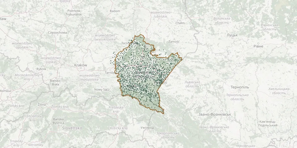 © OpenStreetMap
- Sowina Parish CemeteryGPS coordinates: 49.83136° N, 21.48260° E
- Średnia Wieś Denominational Cemetery (now Roman Catholic)GPS coordinates: 49.41428° N, 22.34745° E
- Środek CemeteryGPS coordinates: 49.98132° N, 21.89656° E
- Stale Parish CemeteryGPS coordinates: 50.56462° N, 21.75545° E
- Stalowa Wola Cholera CemeteryGPS coordinates: 50.60261° N, 22.00542° E
- Stalowa Wola Municipal CemeteryGPS coordinates: 50.56673° N, 22.04255° E
- Stanisławczyk Municipal CemeteryGPS coordinates: 49.72551° N, 22.83879° E
- Stany CemeteryGPS coordinates: 50.44081° N, 21.97629° E
- Stara Jastrząbka CemeteryGPS coordinates: 50.12212° N, 21.24428° E
- Stara Wieś Parish CemeteryGPS coordinates: 49.70845° N, 22.01376° E
- Stare KościeliskoGPS coordinates: 49.67639° N, 21.82968° E
- Stare Oleszyce Greek Catholic CemeteryGPS coordinates: 50.16895° N, 22.98502° E
- Stare Sioło Old CemeteryGPS coordinates: 50.14917° N, 22.95717° E
- Staroniwa CemeteryGPS coordinates: 50.03357° N, 21.97543° E
- Stary Dzików Municipal CemeteryGPS coordinates: 50.24797° N, 22.92927° E
- Stary Lubliniec Parish CemeteryGPS coordinates: 50.29360° N, 23.07318° E
- Stary Żmigród Old Roman Catholic CemeteryGPS coordinates: 49.59485° N, 21.55402° E
- Starzawa World War I War CemeteryGPS coordinates: 49.87639° N, 23.02028° E
- Stasiówka Roman Catholic CemeteryGPS coordinates: 50.01508° N, 21.46172° E
- Stefkowa Roman Catholic CemeteryGPS coordinates: 49.45543° N, 22.47890° E
- Stępina Parish CemeteryGPS coordinates: 49.87159° N, 21.58347° E
- St. Mary Magdalene Parish Cemetery, TarnobrzegGPS coordinates: 50.56362° N, 21.66332° E
- St. Michael the Archangel Parish Cemetery, KańczugaGPS coordinates: 49.98639° N, 22.41110° E
- Stobierna Parish CemeteryGPS coordinates: 50.14018° N, 22.07695° E
- Strachocina Parish CemeteryGPS coordinates: 49.60344° N, 22.09148° E
- Straszęcin Parish CemeteryGPS coordinates: 50.05990° N, 21.35580° E
- Straszydle Roman Catholic CemeteryGPS coordinates: 49.89538° N, 21.97997° E
- Strażów Parish CemeteryGPS coordinates: 50.06407° N, 22.12828° E
- Stróże Małe CemeteryGPS coordinates: 49.53432° N, 22.18179° E
- Strzyżów Cholera CemeteryGPS coordinates: 49.88007° N, 21.80409° E