
Subcarpathian Voivodeship
1,346 known cemeteries in Subcarpathian Voivodeship, Poland.
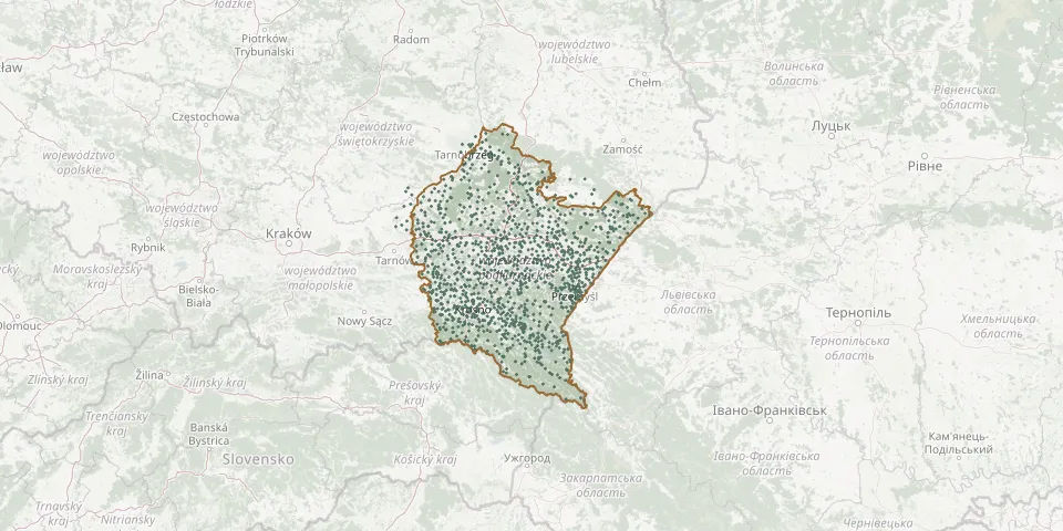 © OpenStreetMap
- Strzyżów Municipal CemeteryGPS coordinates: 49.87176° N, 21.77821° E
- Strzyżów New Jewish CemeteryGPS coordinates: 49.87490° N, 21.80178° E
- Strzyżów Old Roman Catholic CemeteryGPS coordinates: 49.87132° N, 21.78386° E
- Stubienko Greek Catholic Cemetery (now Roman Catholic)GPS coordinates: 49.90511° N, 22.92397° E
- Stubno Municipal CemeteryGPS coordinates: 49.90497° N, 22.95105° E
- Stubno Old Roman Catholic CemeteryGPS coordinates: 49.90389° N, 22.95056° E
- Stubno Orthodox CemeteryGPS coordinates: 49.91560° N, 22.99786° E
- Stubno War CemeteryGPS coordinates: 49.89962° N, 22.95266° E
- Studenne Cemetery and Site of the Former ChurchGPS coordinates: 49.28337° N, 22.44874° E
- Stuposiany Historic CemeteryGPS coordinates: 49.18497° N, 22.68465° E
- Styków Parish CemeteryGPS coordinates: 50.18620° N, 21.94252° E
- Surochów Roman Catholic CemeteryGPS coordinates: 50.01951° N, 22.74990° E
- Surochów War Cemetery (World War I)GPS coordinates: 50.00882° N, 22.78510° E
- Surowica Village CemeteryGPS coordinates: 49.44170° N, 21.90964° E
- Świątkowa Mała Greek Catholic CemeteryGPS coordinates: 49.51400° N, 21.43966° E
- Świątkowa Wielka Lemko CemeteryGPS coordinates: 49.54662° N, 21.40852° E
- Świątkowa Wielka Parish CemeteryGPS coordinates: 49.52495° N, 21.43327° E
- Święcany Parish CemeteryGPS coordinates: 49.77169° N, 21.27088° E
- Święcany War Cemetery No. 30GPS coordinates: 49.77598° N, 21.26971° E
- Święte Parish CemeteryGPS coordinates: 49.92365° N, 22.85241° E
- Świętoniowa Parish CemeteryGPS coordinates: 50.10306° N, 22.43709° E
- Świlcza Roman Catholic CemeteryGPS coordinates: 50.06993° N, 21.90369° E
- Szczucin Parish CemeteryGPS coordinates: 50.30201° N, 21.07891° E
- Szczucin War Cemetery No. 247GPS coordinates: 50.30140° N, 21.07953° E
- Szebnie Municipal CemeteryGPS coordinates: 49.76298° N, 21.59893° E
- Szebnie Soviet Prisoner-of-War CemeteryGPS coordinates: 49.76466° N, 21.57042° E
- Szklary Old Lemko CemeteryGPS coordinates: 49.47339° N, 21.81404° E
- Szklary Roman Catholic CemeteryGPS coordinates: 49.87062° N, 22.24650° E
- Szówsko Parish CemeteryGPS coordinates: 50.04309° N, 22.71132° E
- Szufnarowa Municipal CemeteryGPS coordinates: 49.90812° N, 21.62330° E