
Aargau
167 known cemeteries in Aargau, Switzerland.
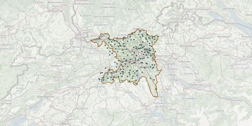 © OpenStreetMap
- Hirschthal CemeteryGPS coordinates: 47.31678° N, 8.05583° E
- Holziken CemeteryGPS coordinates: 47.31884° N, 8.04166° E
- Hornussen CemeteryGPS coordinates: 47.49816° N, 8.06372° E
- Hottwil CemeteryGPS coordinates: 47.54601° N, 8.16538° E
- Hunzenschwil CemeteryGPS coordinates: 47.38406° N, 8.12099° E
- Ittenthal CemeteryGPS coordinates: 47.51758° N, 8.05843° E
- Kaiseraugst CemeteryGPS coordinates: 47.53855° N, 7.72001° E
- Kaiserstuhl CemeteryGPS coordinates: 47.56635° N, 8.41805° E
- Kaisten CemeteryGPS coordinates: 47.54378° N, 8.05390° E
- Katholische kirche SinsGPS coordinates: 47.19470° N, 8.39520° E
- Kirchberg CemeteryGPS coordinates: 47.41081° N, 8.06312° E
- Kirchbözberg CemeteryGPS coordinates: 47.49090° N, 8.16190° E
- Kirchdorf CemeteryGPS coordinates: 47.49688° N, 8.27142° E
- Kirchrued CemeteryGPS coordinates: 47.28501° N, 8.09807° E
- Koblenz CemeteryGPS coordinates: 47.60445° N, 8.23444° E
- Kölliken CemeteryGPS coordinates: 47.33586° N, 8.02586° E
- Kürzi Cemetery, WidenGPS coordinates: 47.36737° N, 8.35762° E
- Laufenburg CemeteryGPS coordinates: 47.55643° N, 8.06117° E
- Lengnau CemeteryGPS coordinates: 47.51925° N, 8.32940° E
- Lenzburg CemeteryGPS coordinates: 47.38366° N, 8.17859° E
- Leuggern CemeteryGPS coordinates: 47.58159° N, 8.21617° E
- Leutwil CemeteryGPS coordinates: 47.30927° N, 8.17415° E
- Liebenfels CemeteryGPS coordinates: 47.46146° N, 8.30615° E
- Mellikon CemeteryGPS coordinates: 47.56668° N, 8.35829° E
- Mellingen CemeteryGPS coordinates: 47.41481° N, 8.27223° E
- Menziken CemeteryGPS coordinates: 47.23513° N, 8.18929° E
- Merenschwand CemeteryGPS coordinates: 47.26040° N, 8.37570° E
- Mettau CemeteryGPS coordinates: 47.56461° N, 8.12604° E
- Möriken CemeteryGPS coordinates: 47.41418° N, 8.18093° E
- Muhen CemeteryGPS coordinates: 47.33590° N, 8.05494° E