
Aargau
167 known cemeteries in Aargau, Switzerland.
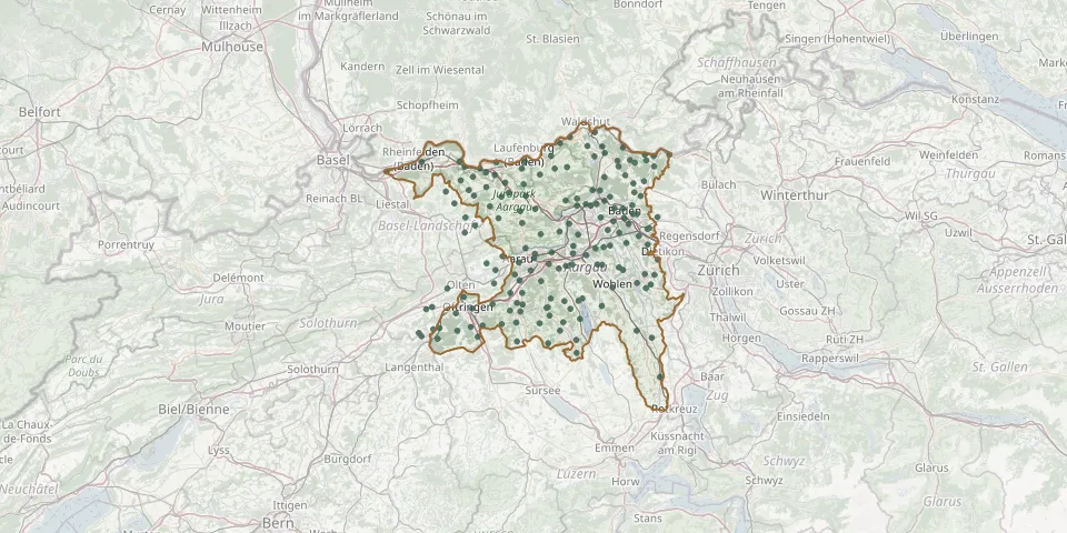 © OpenStreetMap
- Schachen CemeteryGPS coordinates: 47.50702° N, 8.24675° E
- Schafisheim CemeteryGPS coordinates: 47.37662° N, 8.14551° E
- Schneisingen CemeteryGPS coordinates: 47.52253° N, 8.35590° E
- Schöftland CemeteryGPS coordinates: 47.30496° N, 8.05001° E
- Schupfart CemeteryGPS coordinates: 47.51269° N, 7.96638° E
- Schwaderloch CemeteryGPS coordinates: 47.58660° N, 8.14836° E
- Seengen CemeteryGPS coordinates: 47.32650° N, 8.20330° E
- Siglistorf CemeteryGPS coordinates: 47.54775° N, 8.38044° E
- Sisseln CemeteryGPS coordinates: 47.55437° N, 7.99117° E
- Staffelbach CemeteryGPS coordinates: 47.28575° N, 8.04010° E
- Staufberg CemeteryGPS coordinates: 47.38077° N, 8.16287° E
- Stein CemeteryGPS coordinates: 47.54375° N, 7.95085° E
- St. SebastianGPS coordinates: 47.46773° N, 8.32843° E
- Stüsslingen CemeteryGPS coordinates: 47.38563° N, 7.96722° E
- Suhr CemeteryGPS coordinates: 47.37355° N, 8.07548° E
- Sulz CemeteryGPS coordinates: 47.53403° N, 8.09858° E
- Tegerfelden Reformed CemeteryGPS coordinates: 47.55689° N, 8.28967° E
- Teufenthal CemeteryGPS coordinates: 47.32621° N, 8.12512° E
- Thalheim CemeteryGPS coordinates: 47.43425° N, 8.10024° E
- Turgi CemeteryGPS coordinates: 47.49002° N, 8.25796° E
- Uerkheim CemeteryGPS coordinates: 47.30623° N, 8.02442° E
- Umiken CemeteryGPS coordinates: 47.48190° N, 8.19014° E
- Unterendingen CemeteryGPS coordinates: 47.54772° N, 8.29248° E
- Unterentfelden CemeteryGPS coordinates: 47.36654° N, 8.03611° E
- Unterkulm CemeteryGPS coordinates: 47.31076° N, 8.11537° E
- Unterkulm CemeteryGPS coordinates: 47.31171° N, 8.11790° E
- Veltheim CemeteryGPS coordinates: 47.43844° N, 8.14744° E
- Vordemwald CemeteryGPS coordinates: 47.27252° N, 7.89502° E
- Walde CemeteryGPS coordinates: 47.25109° N, 8.11876° E
- Wallbach CemeteryGPS coordinates: 47.55638° N, 7.90123° E