
Aargau
167 known cemeteries in Aargau, Switzerland.
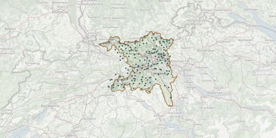 © OpenStreetMap
- Mumpf CemeteryGPS coordinates: 47.54703° N, 7.91306° E
- Münchwilen CemeteryGPS coordinates: 47.53689° N, 7.96545° E
- Münzlihausen CemeteryGPS coordinates: 47.47740° N, 8.28240° E
- Muri CemeteryGPS coordinates: 47.27245° N, 8.33800° E
- Niedergösgen CemeteryGPS coordinates: 47.37424° N, 7.98920° E
- Niederlenz CemeteryGPS coordinates: 47.40194° N, 8.18064° E
- Niederwil CemeteryGPS coordinates: 47.37857° N, 8.29417° E
- Oberentfelden CemeteryGPS coordinates: 47.35705° N, 8.04798° E
- Oberkulm CemeteryGPS coordinates: 47.29762° N, 8.12242° E
- Obermumpf CemeteryGPS coordinates: 47.53043° N, 7.93285° E
- Oeschgen CemeteryGPS coordinates: 47.52009° N, 8.01302° E
- Oftringen CemeteryGPS coordinates: 47.30994° N, 7.93086° E
- Otelfingen CemeteryGPS coordinates: 47.46249° N, 8.38904° E
- OthmarsingenGPS coordinates: 47.39877° N, 8.21333° E
- Papprich CemeteryGPS coordinates: 47.45073° N, 8.31731° E
- Reinach CemeteryGPS coordinates: 47.25656° N, 8.18868° E
- Rein Cemetery, RüfenachGPS coordinates: 47.50784° N, 8.22857° E
- Reitnau CemeteryGPS coordinates: 47.25450° N, 8.04205° E
- Rheinfelden Woodland CemeteryGPS coordinates: 47.55478° N, 7.80640° E
- Riniken CemeteryGPS coordinates: 47.49341° N, 8.19048° E
- Rohr CemeteryGPS coordinates: 47.40125° N, 8.08559° E
- Rohrdorf AG CemeteryGPS coordinates: 47.41970° N, 8.31186° E
- Rothenfluh CemeteryGPS coordinates: 47.46207° N, 7.91500° E
- Rothrist CemeteryGPS coordinates: 47.30157° N, 7.89084° E
- Rudolfstetten-Friedlisberg CemeteryGPS coordinates: 47.36597° N, 8.38167° E
- Rümikon CemeteryGPS coordinates: 47.56460° N, 8.38019° E
- Rupperswil CemeteryGPS coordinates: 47.40409° N, 8.12845° E
- Rütihof CemeteryGPS coordinates: 47.44104° N, 8.26665° E
- Rybetstal Cemetery, BirrGPS coordinates: 47.43382° N, 8.19324° E
- Safenwil CemeteryGPS coordinates: 47.31733° N, 7.98177° E