
Cumbria
297 known cemeteries in Cumbria, United Kingdom.
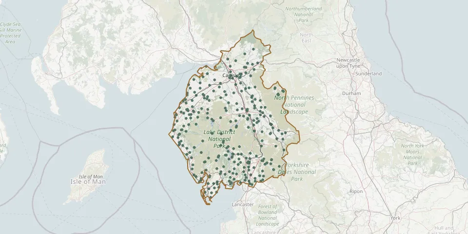 © OpenStreetMap
- Maryport CemeteryGPS coordinates: 54.72945° N, 3.47546° W
- Wigton CemeteryGPS coordinates: 54.82990° N, 3.17691° W
- Cockermouth CemeteryGPS coordinates: 54.65874° N, 3.35427° W
- Thorncliffe Cemetery and CrematoriumGPS coordinates: 54.12978° N, 3.22751° W
- St Kentigerns Church, Great CrosthwaiteGPS coordinates: 54.60879° N, 3.15170° W
- St John the Evangelist ChurchyardGPS coordinates: 54.73735° N, 3.44720° W
- St Paul Church, Holme EdenGPS coordinates: 54.89897° N, 2.82276° W
- Greystoke (Saint Andrew) ChurchyardGPS coordinates: 54.66910° N, 2.86460° W
- Stanwix CemeteryGPS coordinates: 54.91790° N, 2.94070° W
- Kendal CemeteryGPS coordinates: 54.32132° N, 2.73847° W
- Carlisle (Dalston Road) Cemetery and CrematoriumGPS coordinates: 54.87869° N, 2.95155° W
- St John the Baptist Church, Old HuttonGPS coordinates: 54.29197° N, 2.67757° W
- St John ChurchyardGPS coordinates: 54.59847° N, 3.13478° W
- Carlisle Upperby CemeteryGPS coordinates: 54.87553° N, 2.91894° W
- St John the Evangelist ChurchyardGPS coordinates: 54.26474° N, 2.79207° W
- St. James ChurchyardGPS coordinates: 54.73055° N, 3.18131° W
- St. Mary ChurchyardGPS coordinates: 54.61884° N, 3.05185° W
- St John the Baptist Church, MelmerbyGPS coordinates: 54.73048° N, 2.60543° W
- Allonby (Christ Church) ChurchyardGPS coordinates: 54.76712° N, 3.43066° W
- Bowness-on-Windermere CemeteryGPS coordinates: 54.35952° N, 2.92484° W
- Cleator (Saint Leonard) ChurchyardGPS coordinates: 54.50705° N, 3.52399° W
- Mealsgate (Allhallows Old Church) ChurchyardGPS coordinates: 54.76520° N, 3.23900° W
- Natland (Saint Mark) ChurchyardGPS coordinates: 54.29606° N, 2.73762° W
- Kendal Parkside CemeteryGPS coordinates: 54.32109° N, 2.73627° W
- Castle Street CemeteryGPS coordinates: 54.33007° N, 2.73634° W
- St. Cuthbert's ChurchyardGPS coordinates: 55.06360° N, 2.68217° W
- St Michael and All Angels ChurchyardGPS coordinates: 54.74687° N, 3.23544° W
- Priory of St. Mary and St. BegaGPS coordinates: 54.49413° N, 3.59317° W
- Saint Andrews ChurchyardGPS coordinates: 54.32307° N, 2.52852° W
- St. Mary's ChurchyardGPS coordinates: 55.03338° N, 2.77865° W