
Thuringia
2,006 known cemeteries in Thuringia, Germany.
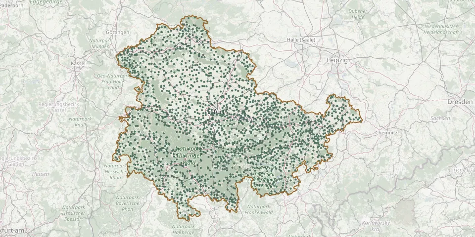 © OpenStreetMap
- Küllstedt CemeteryGPS coordinates: 51.27208° N, 10.28141° E
- Kulm CemeteryGPS coordinates: 50.50795° N, 11.75716° E
- Künsdorf CemeteryGPS coordinates: 50.47800° N, 11.77379° E
- Kurtschau CemeteryGPS coordinates: 50.66016° N, 12.15625° E
- Kutzleben CemeteryGPS coordinates: 51.19509° N, 10.86319° E
- Landeskirche CemeteryGPS coordinates: 50.48511° N, 11.66914° E
- Landsendorf CemeteryGPS coordinates: 50.54940° N, 11.51284° E
- Langenbach CemeteryGPS coordinates: 50.51055° N, 10.84573° E
- Langenberg CemeteryGPS coordinates: 50.91675° N, 12.05791° E
- Langenbuch Cemetery (Schleiz)GPS coordinates: 50.56651° N, 11.90683° E
- Langendembach CemeteryGPS coordinates: 50.74362° N, 11.62661° E
- Langenfeld Municipal CemeteryGPS coordinates: 50.78716° N, 10.21085° E
- Langenhain CemeteryGPS coordinates: 50.90451° N, 10.51999° E
- Langenorla CemeteryGPS coordinates: 50.74078° N, 11.57510° E
- Langenroda CemeteryGPS coordinates: 51.27791° N, 11.36351° E
- Langenschade CemeteryGPS coordinates: 50.70298° N, 11.40032° E
- Langenwetzendorf CemeteryGPS coordinates: 50.68150° N, 12.09601° E
- Langenwolschendorf CemeteryGPS coordinates: 50.63584° N, 11.95255° E
- Langewiesen CemeteryGPS coordinates: 50.66895° N, 10.97508° E
- Langgrün CemeteryGPS coordinates: 50.45954° N, 11.77197° E
- Laskau CemeteryGPS coordinates: 50.66051° N, 11.66470° E
- Laucha CemeteryGPS coordinates: 50.92895° N, 10.54488° E
- Lauchröden CemeteryGPS coordinates: 50.99058° N, 10.16017° E
- Laudenbach CemeteryGPS coordinates: 50.80424° N, 10.41277° E
- Lauscha CemeteryGPS coordinates: 50.47868° N, 11.16039° E
- Lausnitz CemeteryGPS coordinates: 50.67160° N, 11.50106° E
- Lausnitz CemeteryGPS coordinates: 50.72754° N, 11.69293° E
- Lautenbergsiedlung CemeteryGPS coordinates: 50.59867° N, 10.65708° E
- Lauterbach CemeteryGPS coordinates: 51.07088° N, 10.35170° E
- Lederhose CemeteryGPS coordinates: 50.80141° N, 11.91780° E