
Thuringia
2,006 known cemeteries in Thuringia, Germany.
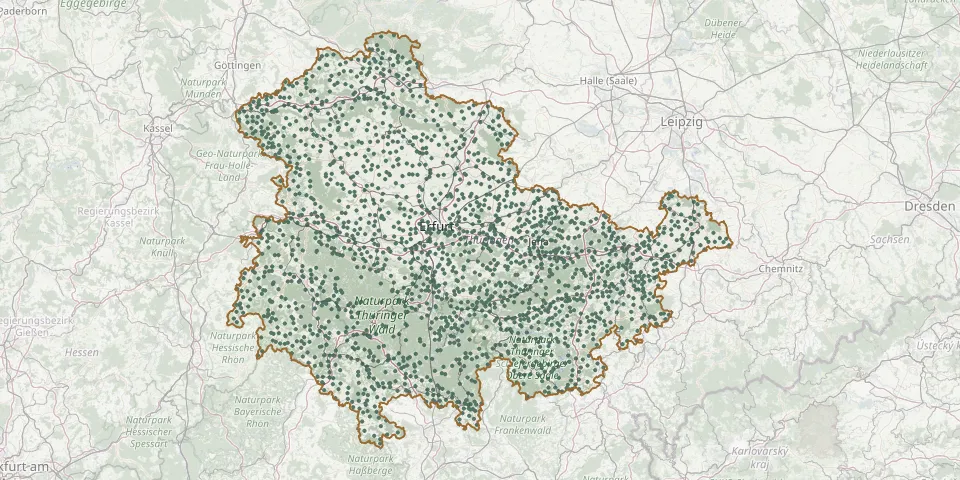 © OpenStreetMap
- Legefeld CemeteryGPS coordinates: 50.93399° N, 11.29745° E
- Lehesten CemeteryGPS coordinates: 50.47607° N, 11.45254° E
- Lehesten CemeteryGPS coordinates: 50.98321° N, 11.57745° E
- Lehna CemeteryGPS coordinates: 51.26386° N, 10.12626° E
- Lehndorf CemeteryGPS coordinates: 50.93519° N, 12.42626° E
- Lehnstedt CemeteryGPS coordinates: 50.93882° N, 11.44127° E
- Leimbach CemeteryGPS coordinates: 51.49882° N, 10.86538° E
- Leimbach Cemetery (Wartburgkreis)GPS coordinates: 50.81332° N, 10.19219° E
- Leimrieht CemeteryGPS coordinates: 50.41080° N, 10.68350° E
- Leina CemeteryGPS coordinates: 50.90521° N, 10.62960° E
- Leinefelde CemeteryGPS coordinates: 51.39192° N, 10.31641° E
- Leitlitz CemeteryGPS coordinates: 50.61486° N, 11.96256° E
- Lemnitz CemeteryGPS coordinates: 50.72080° N, 11.83475° E
- Lengefeld CemeteryGPS coordinates: 51.25627° N, 10.39125° E
- Lengefeld Cemetery (Blankenhain)GPS coordinates: 50.82873° N, 11.34547° E
- Lengenfeld Mountain CemeteryGPS coordinates: 51.22070° N, 10.20877° E
- Lengenfeld unterm Stein CemeteryGPS coordinates: 51.21565° N, 10.22035° E
- Lengfeld CemeteryGPS coordinates: 50.52461° N, 10.65443° E
- Lenterode CemeteryGPS coordinates: 51.34246° N, 10.06828° E
- Letzendorf CemeteryGPS coordinates: 50.79536° N, 12.15509° E
- Leutenberg CemeteryGPS coordinates: 50.56372° N, 11.45967° E
- Leutenthal CemeteryGPS coordinates: 51.05482° N, 11.37187° E
- Leutersdorf Cemetery (Thüringen)GPS coordinates: 50.51948° N, 10.55814° E
- Leutra Cemetery (Jena)GPS coordinates: 50.86988° N, 11.56541° E
- Lichstedt CemeteryGPS coordinates: 50.73023° N, 11.25996° E
- Lichte CemeteryGPS coordinates: 50.52161° N, 11.18375° E
- Lichtenau CemeteryGPS coordinates: 50.75366° N, 11.69788° E
- Lichtenbrunn CemeteryGPS coordinates: 50.41806° N, 11.64188° E
- Lichtenhain CemeteryGPS coordinates: 50.49882° N, 11.30892° E
- Lichtenhain CemeteryGPS coordinates: 50.59615° N, 11.12102° E