
Utrecht
180 known cemeteries in Utrecht, Netherlands.
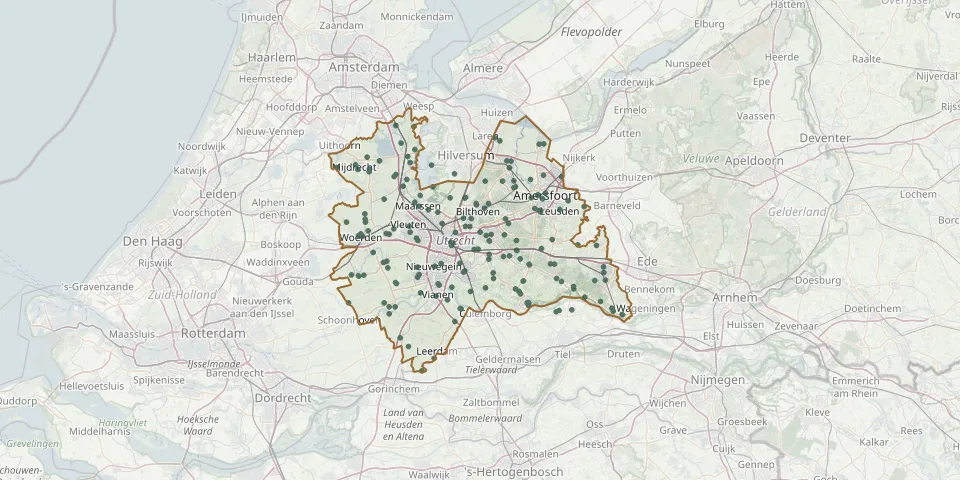 © OpenStreetMap
- Dalweg CemeteryGPS coordinates: 52.18132° N, 5.30235° E
- De Akker CemeteryGPS coordinates: 52.24356° N, 5.38490° E
- De Beaufort CemeteryGPS coordinates: 52.04100° N, 5.40371° E
- De Hoef CemeteryGPS coordinates: 52.20360° N, 4.81630° E
- De Hoge Akker Cemetery, EiterenGPS coordinates: 52.03540° N, 5.03714° E
- De Langenoord ChurchyardGPS coordinates: 52.19053° N, 5.38416° E
- De Larikshof Cemetery, RemmerdenGPS coordinates: 51.97755° N, 5.54088° E
- De Meern Protestant CemeteryGPS coordinates: 52.08464° N, 5.03497° E
- De Meern Roman Catholic ChurchyardGPS coordinates: 52.08064° N, 5.03900° E
- De Munnikenhof General CemeteryGPS coordinates: 52.03616° N, 5.54933° E
- Den en Rust Natural Burial GroundGPS coordinates: 52.14302° N, 5.19930° E
- De Stuivenberg Montfoort CemeteryGPS coordinates: 52.03471° N, 4.95687° E
- Doorn General CemeteryGPS coordinates: 52.04065° N, 5.34524° E
- Doorn New General CemeteryGPS coordinates: 52.04979° N, 5.31982° E
- Doorn Old General CemeteryGPS coordinates: 52.03971° N, 5.34594° E
- Dreef General CemeteryGPS coordinates: 52.15029° N, 4.94701° E
- Driebergen Old General CemeteryGPS coordinates: 52.05462° N, 5.29091° E
- Driebergen-Rijsenburg New CemeteryGPS coordinates: 52.06411° N, 5.31009° E
- Eck en Wiel CemeteryGPS coordinates: 51.96348° N, 5.46211° E
- Eemnes General CemeteryGPS coordinates: 52.25347° N, 5.25097° E
- Eemnes Roman Catholic CemeteryGPS coordinates: 52.24830° N, 5.26410° E
- Eiteren CemeteryGPS coordinates: 52.02330° N, 5.04230° E
- Elst Commonwealth War GravesGPS coordinates: 51.98477° N, 5.49793° E
- Everdingen Dutch Reformed Church ChurchyardGPS coordinates: 51.96570° N, 5.15540° E
- Everdingen Roman Catholic CemeteryGPS coordinates: 51.96517° N, 5.15780° E
- Godsakker (Evangelische Broedergemeente)GPS coordinates: 52.08026° N, 5.23470° E
- Grebbeberg Military CemeteryGPS coordinates: 51.95563° N, 5.60042° E
- Groenedijk Roman Catholic CemeteryGPS coordinates: 52.01880° N, 5.03830° E
- Groenekan CemeteryGPS coordinates: 52.11857° N, 5.16481° E
- Groeneveld Family Cemetery, WoerdenGPS coordinates: 52.08833° N, 4.87582° E