
Utrecht
180 known cemeteries in Utrecht, Netherlands.
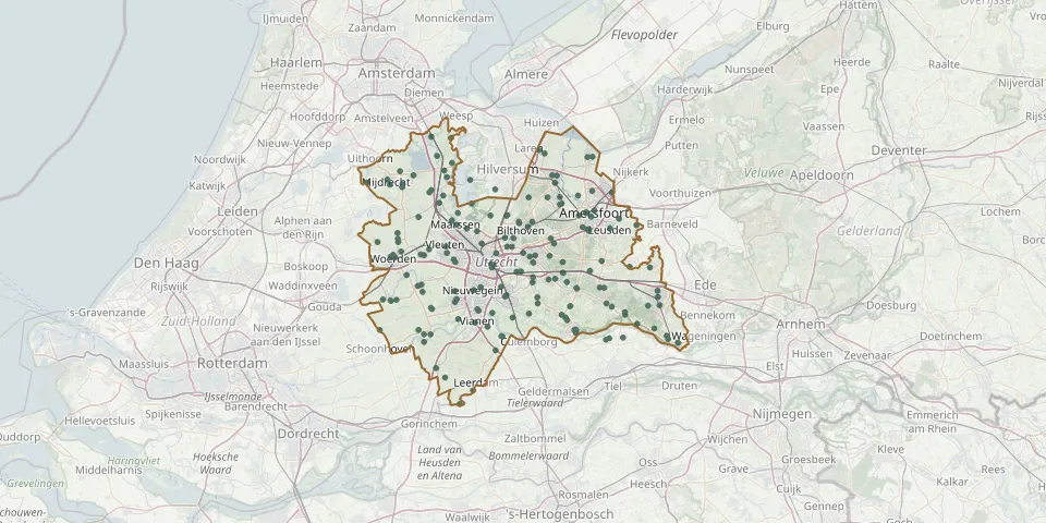 © OpenStreetMap
- Lopikerkapel ChurchyardGPS coordinates: 51.99230° N, 5.04620° E
- Maarn Catholic CemeteryGPS coordinates: 52.06737° N, 5.37904° E
- Maarssen Dutch Reformed ChurchyardGPS coordinates: 52.13840° N, 5.04240° E
- Maarssen General CemeteryGPS coordinates: 52.14515° N, 5.03067° E
- Maarssen Jewish CemeteryGPS coordinates: 52.15636° N, 5.04555° E
- Maartensdijk General CemeteryGPS coordinates: 52.15340° N, 5.16980° E
- Maartensdijk New General CemeteryGPS coordinates: 52.15199° N, 5.16832° E
- Maranatha Roman Catholic Cemetery, AmersfoortGPS coordinates: 52.13162° N, 5.37564° E
- Maria Cemetery, SoestGPS coordinates: 52.18080° N, 5.27190° E
- Maurik CemeteryGPS coordinates: 51.96250° N, 5.42710° E
- Maurik CemeteryGPS coordinates: 51.96022° N, 5.41905° E
- Meerkerk General CemeteryGPS coordinates: 51.91576° N, 4.99083° E
- Meeuwenlaan CemeteryGPS coordinates: 52.09207° N, 4.88279° E
- Mijdrecht ChurchyardGPS coordinates: 52.20840° N, 4.86780° E
- Mijdrecht Parish ChurchyardGPS coordinates: 52.20038° N, 4.87389° E
- Montfoort General CemeteryGPS coordinates: 52.04348° N, 4.94517° E
- Montfoort Roman Catholic CemeteryGPS coordinates: 52.04546° N, 4.95406° E
- Nederlands erehofGPS coordinates: 52.06355° N, 5.31120° E
- Nieuwe GodsakkerGPS coordinates: 52.07942° N, 5.23624° E
- Nieuwer-Ter-Aa CemeteryGPS coordinates: 52.18850° N, 4.97390° E
- Nieuwer Ter Aa Old Dutch Reformed ChurchyardGPS coordinates: 52.19179° N, 4.97881° E
- Nieuwe ZandwegGPS coordinates: 52.06055° N, 4.91644° E
- Nieuwland CemeteryGPS coordinates: 51.90132° N, 5.01365° E
- Nigtevecht Dutch Reformed ChurchyardGPS coordinates: 52.27270° N, 5.02920° E
- Noorderveld CemeteryGPS coordinates: 52.04186° N, 5.10298° E
- Odijk Dutch Reformed CemeteryGPS coordinates: 52.04900° N, 5.23420° E
- Odijk General CemeteryGPS coordinates: 52.05726° N, 5.23520° E
- Onze Lieve Vrouwe ChurchyardGPS coordinates: 52.11745° N, 5.27955° E
- Onze Lieve Vrouwe ten Hemelopneming CemeteryGPS coordinates: 52.00080° N, 5.22450° E
- Onze Lieve Vrouw ten Hemelopneming Roman Catholic CemeteryGPS coordinates: 52.02699° N, 5.16456° E